Pearl River
Brandon, Mississippi, United States
Pearl River just downstream from the Ross Barnett Reservoir Spillway dam. East side of the Pearl just upstream from where Pelahatchie Creek enters.
Location created by
Abby Braman
- Group: Mississippi State University : Mississippi Water Stewards
- Lat: 32.3944936
- Lng: -90.0654244
- Waterbody Type: River
- Timezone: America/Chicago
Latest photos


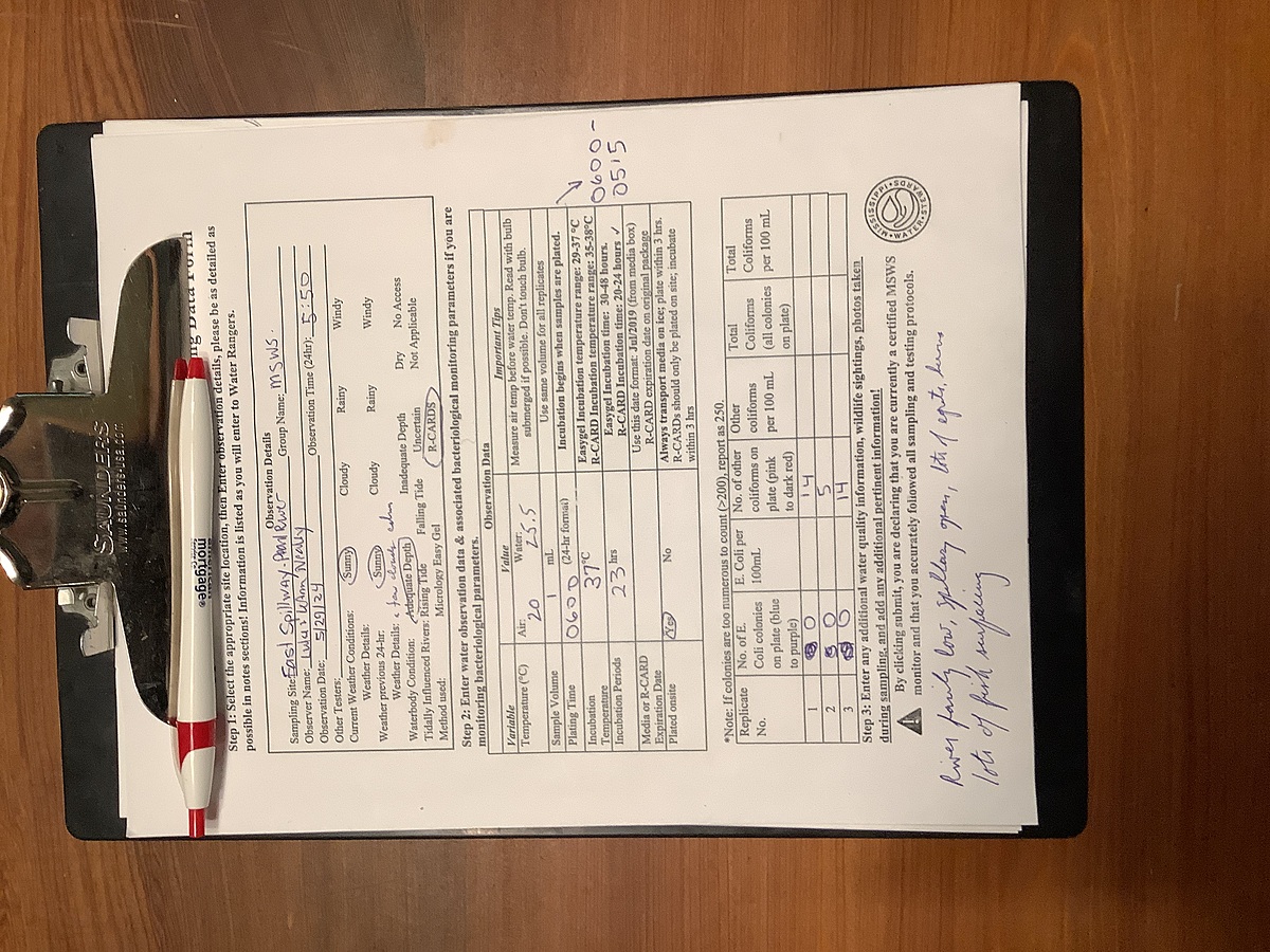
River lower, spillway open a little, one heron several egrets (much less than last week), many mayflies, plus gnats and other small flying insects.
River up from rain; numerous egrets near spillway and along shore actively fishing; spillway wide open
River fairly low, spillway open, lots of egrets, herons, lots of fish surfacing
Warm and light breeze, numerous gnats, river fairly low, some fishermen, a few egrets at dam
River very high, many fisherman on rankin county side; Madison county side was closed due to high water; water calm, some foam; all gates on the spillway were open
Cold; strong north wind;a few wading birds, vultures; water low; no appreciable rain in 6-8 weeks
Water very low, breezy, no wading birds, some dead fish on bank and dead gar in the water (appear to have been thrown back)
Water very low; hot, a few clouds; a few egrets and herons; exposed logs and debris mid-river
Water very low, exposed sand bars and logs; herons on logs; river very calm; fish feeding on surface
Water low; herons on exposed logs in river; fish feeding; water very smooth; spillway not very open. Full moon, sun not up, bunch of egrets in trees