Pearl River
Brandon, Mississippi, United States
Pearl River just downstream from the Ross Barnett Reservoir Spillway dam. East side of the Pearl just upstream from where Pelahatchie Creek enters.
Location created by
Abby Braman
- Group: Mississippi State University : Mississippi Water Stewards
- Lat: 32.3944936
- Lng: -90.0654244
- Waterbody Type: River
- Timezone: America/Chicago
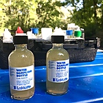
Latest photos


River very low; 1 gate open good flow; a few egrets in trees; some herons on deadfall and bars; beautiful cooler morning; osprey on dead tree on West Bank
River very low; 1 gate open and not much flow; river flow also slow; a few herons and egrets downriver. Algae coating submerged rocks and clumps of brown and green algae in the water, floating near shore
River low. One gate open, a lot of egrets flying around and large group of them on west beach. Herons on bars.
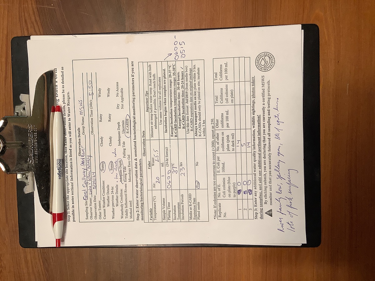
River very low; 1 gate open; herons and egrets on bars downriver and at dam; a few fishermen. Watery murky; algae slime covering underwater rocks. R-cards worked-see photo.
Included photos of R-cards-other coliforms are quite faint, no E. coli indicated. Air still. River low; many deadfalls and bars visible. A few fishermen. Two gates open. A few herons downriver.
River low-average;deadfall visible; hot still late afternoon; 3 gates open; several herons on deadfall
Concerned that R-cards showed nothing, not even faint dots. I checked this morning (about 12 hours later) and still showed nothing. Will check on getting new R-cards
Hot; still. 3 gates open; river depth below average; trees showing in river; a few egrets at dam; herons along river and one on beach. Very few fishermen
2 gates open and far east gate partially open; no birds, many fishermen
Average water level; 2 gates open; a few fishermen; a few egrets, herons
River up, but not too high; 2 gates wide open on spillway; herons and egrets as sun is coming up