Pearl River
Brandon, Mississippi, United States
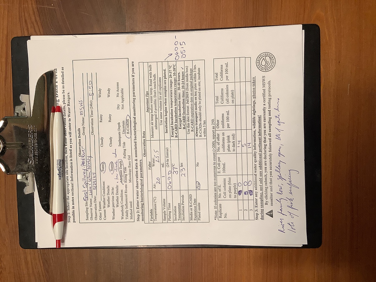
Pearl River just downstream from the Ross Barnett Reservoir Spillway dam. East side of the Pearl just upstream from where Pelahatchie Creek enters.
Location created by
Abby Braman
- Group: Mississippi State University : Mississippi Water Stewards
- Lat: 32.3944936
- Lng: -90.0654244
- Waterbody Type: River
- Timezone: America/Chicago
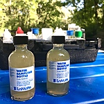
Latest photos


A dozen or so herons, a few egrets and six geese on exposed sandbar mid-river; several fish breaking the surface and many aquatic bugs on surface of river; very calm surface. River low, several wide sand bars and dead falls exposed. Water flow at spillway through one gate and a small amount of flow through a second gate.
Much cooler and drier today: 1 gate open, river up slightly; some herons; super blue moon still showing in early morning sky
River low but up a little from last week; 1 gate open a little flow; a few egrets and herons on logs and sand bars in the river; river very smooth
River low, one gate open, moderate flow. Algae on submerged rocks and river bottom close to shore. River very calm, fish breaking surface, a few herons and egrets, but not as many as usual . Sun not up yet.
River up, 2 gates open, numerous egrets , fish breaking surface
Water up significantly from last weeks. 2 gates open, a lot of flow. Fish breaking the surface; many fishermen; a few egrets/ herons; logs and sandbars are covered with water downriver
River very low; 1 gate open on dam; several herons and egrets on sand bars and exposed logs; fish breaking surface; a lot of insects on water
River very low; 1 gate on spillway partially open; a few herons and egrets downriver on exposed logs and sandbars
River low; very calm water, smooth surface, some fish breaking the surface; a few herons today, no egrets; a few small clumps of algae in the water
Water very low;exposed sand bars and trees; a few egrets and herons