Pearl River
Brandon, Mississippi, United States
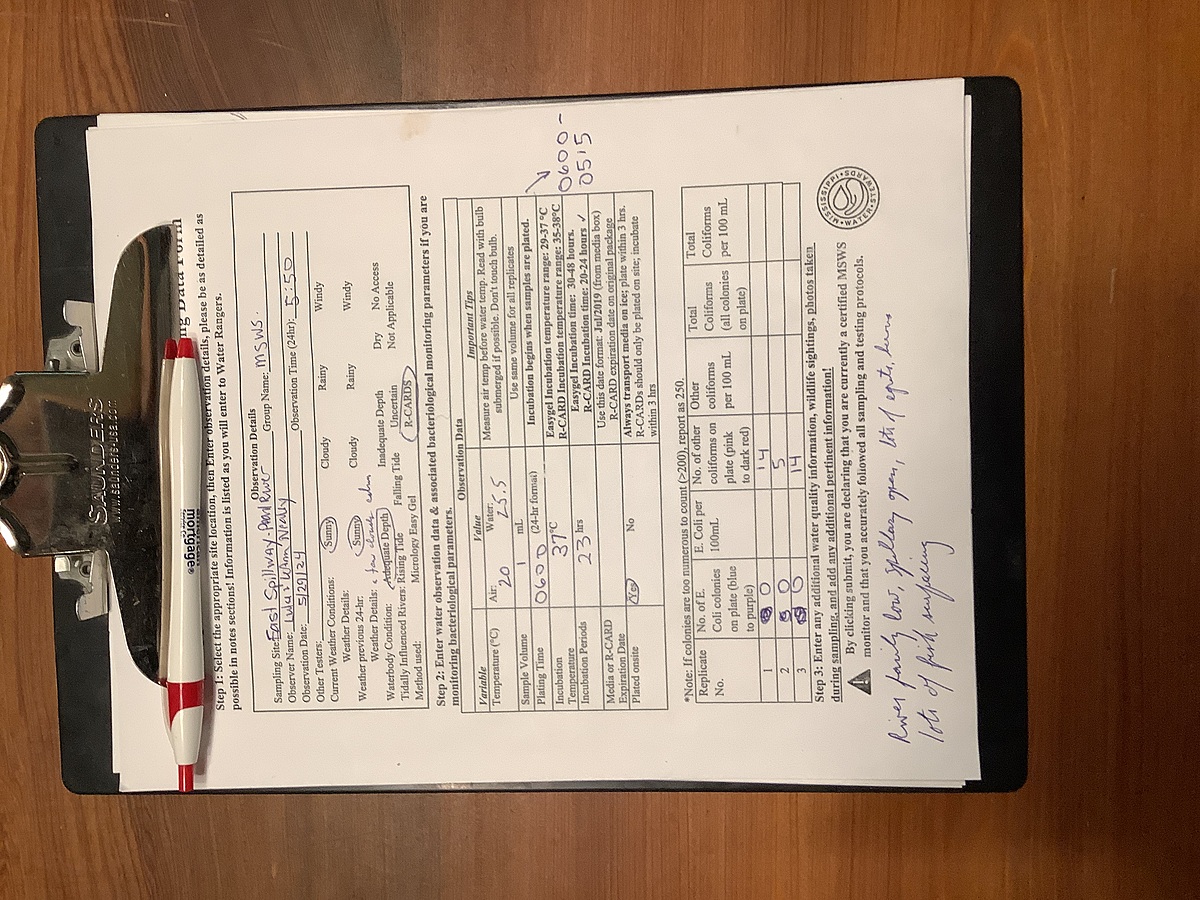
Pearl River just downstream from the Ross Barnett Reservoir Spillway dam. East side of the Pearl just upstream from where Pelahatchie Creek enters.
Location created by
Abby Braman
- Group: Mississippi State University : Mississippi Water Stewards
- Lat: 32.3944936
- Lng: -90.0654244
- Waterbody Type: River
- Timezone: America/Chicago
Latest photos


River way down from last couple of days; 2 gates wide open; blue herons; large gator swimming downstream near west side of river
River medium high, heavy recent rains, two gates open, heavy flow. Some herons and egrets and many fishermen
Water up; 2 gates open on spillway; a lot of fishermen; a few herons and egrets
A few white pelicans, egrets, a few herons. River up, but not too high, a lot of foam, two gates open, a lot of fishermen
River very high, tremendous amount of foam on river and up pelahatchie creek; about 20 egrets on banks and in trees; a few seagulls; all 8 gates open, high water flowing fast
Light rain; light rain during night. One gate open, water level covering bars. Egrets, herons, about a dozen white pelicans under spillway and upriver, seagulls
2 gates open; river up- all logs and bars covered; many seagulls on and above river; many egrets roosting in trees; some herons trying to land on submerged logs
River up some , 2 gates open; no birds, sun setting
Water very low; calm, couple of herons and egrets; low flow, one gate open
A few egrets and blue herons; lots of fish breaking the surface; 2 gates open on the spillway, but water fairly low