Napanee River (between Yarker and Camden East)
Ontario, Canada
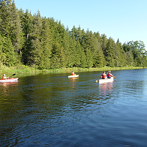
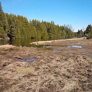
Clear, slow moving water throughout the year and approximately 6-7 feet in depth throughout the Summer. The river is approximately 80 feet across at this location. Perfect recreation area for swimming, canoeing, and kayaking.
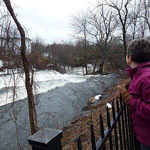
Small (but portage-able) rapids 1/2 km upstream and 1 km downstream.
Major falls at Yarker and Newburgh, otherwise the river is navigable from the beginning of the Napanee Watershed at the Depot Lakes in the north to the end of the watershed flowing into the Bay of Quinte at the town of Napanee.
Location created by
Lawrence O'Keeffe
- Group: Friends of the Napanee (Ontario, Canada)
- Lat: 44.3591291
- Lng: -76.784842
- Waterbody Type: River
- Timezone: America/Toronto
Latest photos
View all photosIssues Summary
Observations summary
Observation tests summary
Air temperature
°C
10.0
Latest
16.2
Average
Water temperature
°C
6.5
Latest
16.6
Average
Alkalinity
mg/L
80
Latest
97
Average
Hardness
mg/L
200
Latest
185
Average
Dissolved oxygen
mg/L
9.0
Latest
7.3
Average
Conductivity
μS/cm
105
Latest
192
Average
Secchi depth
m
2.0
Latest
1.8
Average
pH (0-14)
7.2
Latest
7.4
Average
Water depth
m
2.4
Latest
2.2
Average
Nitrates
mg/L
0.0
Latest
0.0
Average
Phosphates total
ppm
0.0
Latest
0.0
Average
Ice On
- 2024-12-21
- 2021-01-24
- 2017-03-24
Ice Off
- 2025-03-14
- 2022-03-10
- 2021-03-12
- 2020-03-22

