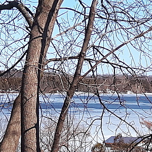
Ottawa River
Chute à Blondeau, Ontario, Canada
The Ottawa River just above the Carillon Dam and the reservoir called Lac dollard-des-ormeaux.
The water moves Eastward slowly. It is a boating recreational area just above voyageur Provincial Park.

- Group: County Sustainability Group
- Lat: 45.5890834
- Lng: -74.4677304
- Waterbody Type: River
- Timezone: America/Toronto
Latest photos
View all photosMy auger blade needs to be sharpened so I wait for a fisherman to be finished with his ice hole after using a gas powered one. 😁
It's quite a late freeze. Personally, I wouldn't trust the ice till mid february, if that.
The water still low in the reservoir above the dam. No docks out yet.
Hopefully the next test will be off the end of the dock. 😄
The ice finally opened down the middle. It's been open for a while up River but we are near the reservoir for the dam and it's always the last to break up.
The ice finally opened down the middle. It's been open for a while up River but we are near the reservoir for the dam and it's always the last to break up.
I had to wait this month till someone went ice fishing with a gas-powered auger. It would have taken me over an hour to get through two feet of ice with my hand powered auger.
I'm learning a lot about winter water testing. It's challenging but a lot of fun.😊❄
I didn't invite the dogs today because of how dangerous the ice is this time of year.
It will be a good old-fashioned winter this year with the river frozen over and lots of snow.
I have to remember to bring a pencil the next time because my pen started to freeze. The winter testing is so different from the summer. ❄😄


