McGee Creek
Ontario, Canada
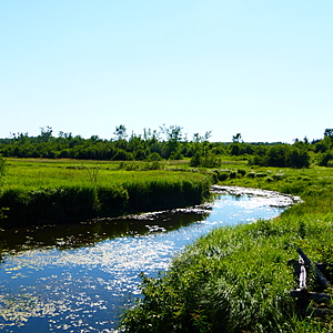
A wide, slow-moving section of McGee Creek before it flows into Canal Lake. Testing site is down the bank from Centennial Park Road, just beside the bridge over the creek.

- Group: Couchiching Conservancy : Community Science Water Monitoring Program
- Site ID: WQ10
- Lat: 44.5961208
- Lng: -79.0476608
- Waterbody Type: Creek
- Timezone: America/Toronto
Latest photos
View all photosSite and significant stretch up and downstream completely frozen over. Water level is high, significant floodplain visible and also frozen over.
Cool, rainy previous day. Rained during testing. Milkweed pods have opened completely.
Unseasonably cool, light rain previous day. Milkweed pods are opening. Nuthatch heard calling. Rabbit scat on bank.
Heavy rain in the past 48 hours. Damselflies, great spangled fritillary, monarch, cabbage white and clouded sulphur butterflies all sighted. Milkweed, pincherries and thistle growing on stream bank. Crow and goldfinches heard calling.
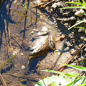
Testing was carried out with a LaMotte Environmental Educator kit. Emerald Shiners and Blacknose Dace were sighted swimming near the test site. A pair of Northern Rough-winged Swallows were seen nesting under the bridge and carrying food to their hatchlings during testing. Several green frogs were heard calling along the bank during testing as well.
Testing carried out using a LaMotte Environmental Educator field kit. Several Emerald Shiners were seen swimming near the site. A Great Blue Heron was also seen flying overhead during testing.


