Larder Lake
Ontario, Canada
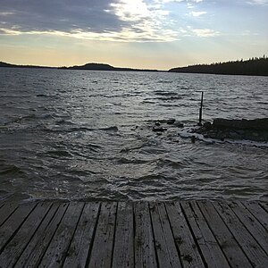
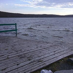
Easily accessible location beside the boat launch where the picnic table sits . This is close to the eastern most point of Larder Lake where the river flows into the lake from other lakes. This is also where the Kerr Adison mine operated for many decades as one of the largest gold mines in the world at the time of it's peak production. Back then mine tailings were routinely dumped directly into the lake here...fortunately the mine has been closed for a long time.

- Group: County Sustainability Group
- Lat: 48.1270426
- Lng: -79.5849609
- Waterbody Type: Lake
- Timezone: America/Toronto
Latest photos
View all photosLarder Lake : Virginiatown Community Park & Boat Launch/Marina
Observed on
2025-08-29
Partly cloudy with calm wind. Seagulls around.
Larder Lake : Virginiatown Community Park & Boat Launch/Marina
Observed on
2025-05-16
Larder Lake : Virginiatown Community Park & Boat Launch/Marina
Observed on
2024-07-19
Partly cloudy with no rain in past 24 hrs.
Larder Lake : Virginiatown Community Park & Boat Launch/Marina
Observed on
2023-12-01
Larder Lake : Virginiatown Community Park & Boat Launch/Marina
Observed on
2023-09-20
Sunny and fairly calm day with no rain in past 24 hrs. No wildlife seen or heard at this time.
Larder Lake : Virginiatown Community Park & Boat Launch/Marina
Observed on
2023-06-28
Sunny clear sky after smoke cleared from the area overnight. Some rain in past 24 hrs. Pair of lo...
Larder Lake : Virginiatown Community Park & Boat Launch/Marina
Observed on
2023-05-02
Larder Lake : Virginiatown Community Park & Boat Launch/Marina
Observed on
2022-12-02
Larder Lake : Virginiatown Community Park & Boat Launch/Marina
Observed on
2022-09-01
Clear sky with just a few clouds , strong westerly winds. Over the past 24 hrs has been a fair bi...
Larder Lake : Virginiatown Community Park & Boat Launch/Marina
Observed on
2022-06-05
Partly cloudy with a lot of rain in past 24 hours. Saw a red fox on the highway near here as I cy...


