Stormwater drain south of 23rd St and west of Chesterfield - WAG-E-07 High Priority
North Vancouver, British Columbia, Canada
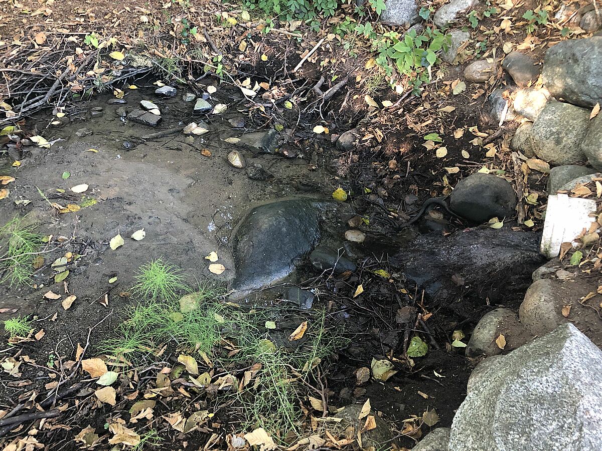
location of WAG-E-07 using zoom on web app. West of Chesterfield and south of 23rd St. a storm drain emerges and then joins the west branch of Wagg Creek from the east. Here a white plastic storm pipe of 0.21m inside diameter comes in from the east about 15m east of the creek. Low energy location. Field measured GPS coordinates in NAD83 are -123.0757406, 49.32946420 in Long and Lat, or UTM 494,497E, 5,464,085N . MISMATCH with CNVGIS mapping which has a 915 CONC Storm pipe here.

Location created by
Paul Lhotka
- Site ID: WAG-E-07
- Lat: 49.3293594
- Lng: -123.0755853
- Waterbody Type: Unknown
- Timezone: America/Vancouver
Latest photos
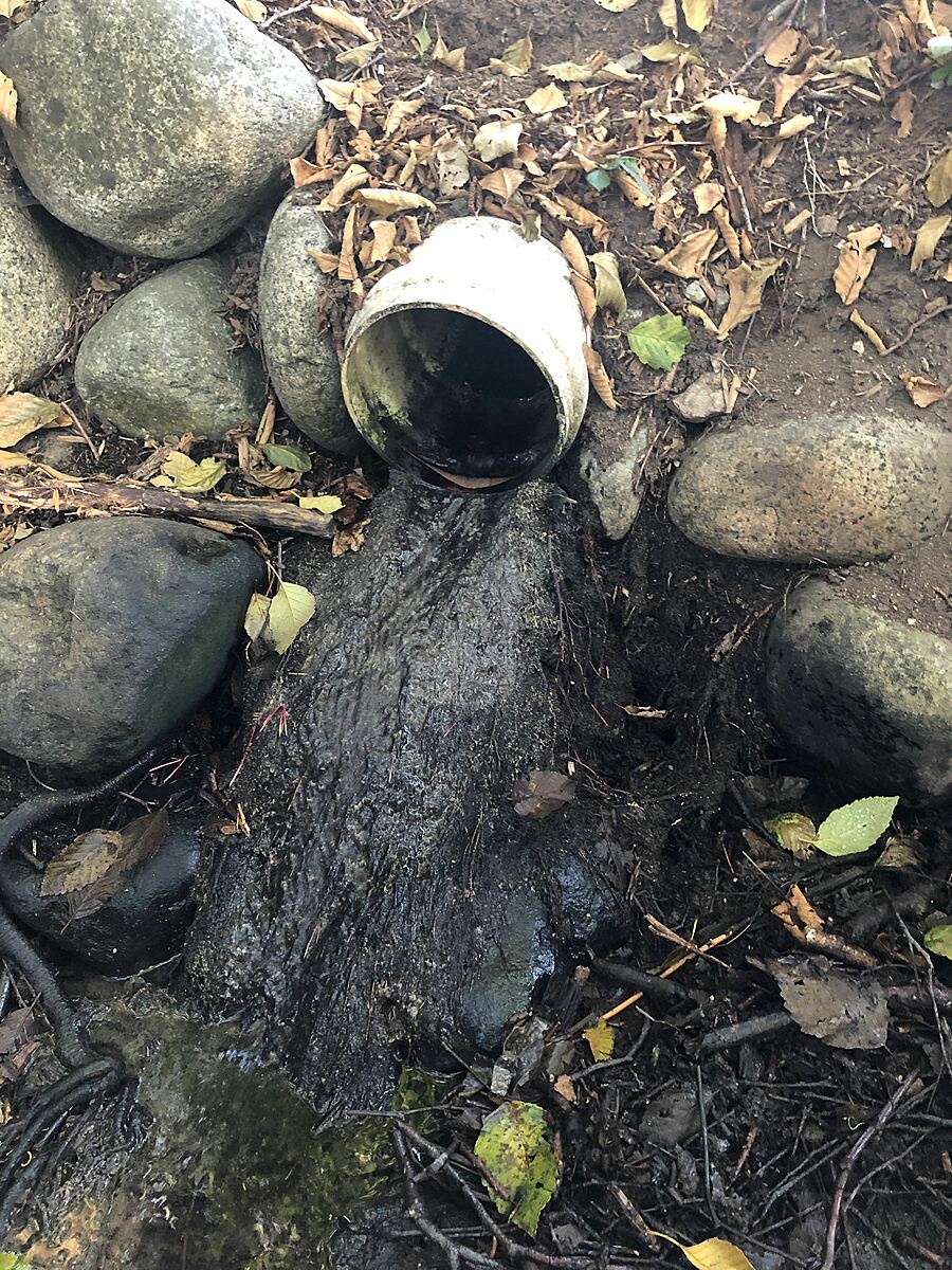

very small trickle of water discharging. water very clear.
In the past water temp taken from EC meter. Instant read digital registers nearly 1 degree lower, which is believed more accurate. I will use air temp fr digital from now on.
Conductivity confirmed by measuring in different spots of pool. EC is 150 at 16.9 celsius.
small trickle from pipe. low water, iron oxide (?) staining. pool filled in with sediment.
very low water flow. pool is more filled in with sand. trickle from pipe, then a big flush.
Water is turbid. Sediment has been deposited. This outfall has been the source of multiple sediment spills from the community centre construction site in the past 4-5 weeks. One leak on the site has yet to be identified, there may be continued turbidity during rainfall until it is found and fixed.
Started using pH meter instead of test strips, reading is 8.1, substantially higher than test strips. Have now deleted pH value as I suspect the meter was incorrectly calibrated.
Previous day: heavily turbid water during heavy rains. Suspected erosion from construction site (Harry Jerome construction). In the past month, there have been multiple contamination events: cement wash 3 weeks ago and laundry soap one week ago.
Spill noted, reported to CNV.
High pH value - off the scale of WR chart. Estimate about 10. For comparison, tested pH and water hardness downstream; pH downstream was 8.4, alkalinity/water hardness had lower values. Relayed to CNV that concrete contaminiation suspected.
Update: Source of spill identified. Concrete overpass being taken down on 23rd St for new community centre. Concrete slurry was making its way into storm drain.
heavy rain last 2 days. catchment was salted due to freezing in past week.
some invasives coming back to the pool edge.
**did the test strips 2x and took average of the 2 tests for alk and hardness. as 1st test was read too quickly.
i'm
Leaves forming debris pile where water flows out of pool.
Side channel moving faster than usual; water is cloudy; white froth pooling by pipe