Stormwater drain south of 23rd St and west of Chesterfield - WAG-E-07 High Priority
North Vancouver, British Columbia, Canada
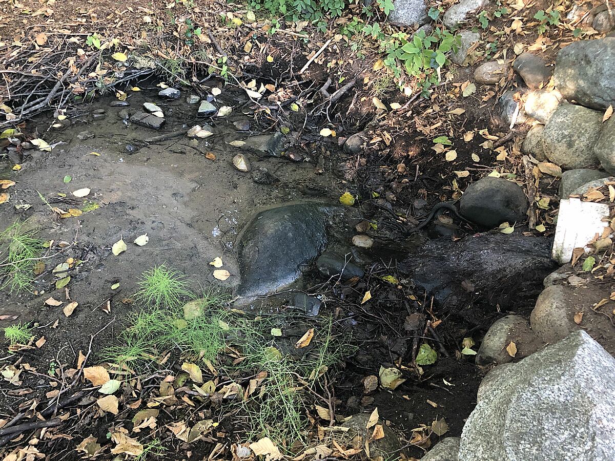
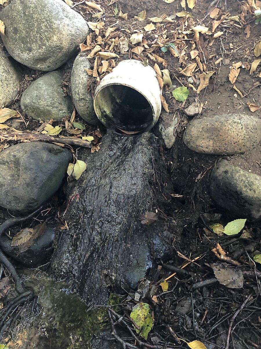
location of WAG-E-07 using zoom on web app. West of Chesterfield and south of 23rd St. a storm drain emerges and then joins the west branch of Wagg Creek from the east. Here a white plastic storm pipe of 0.21m inside diameter comes in from the east about 15m east of the creek. Low energy location. Field measured GPS coordinates in NAD83 are -123.0757406, 49.32946420 in Long and Lat, or UTM 494,497E, 5,464,085N . MISMATCH with CNVGIS mapping which has a 915 CONC Storm pipe here.

Location created by
Paul Lhotka
- Site ID: WAG-E-07
- Lat: 49.3293594
- Lng: -123.0755853
- Waterbody Type: Unknown
- Timezone: America/Vancouver
Latest photos


Observations summary
Observation tests summary
Water temperature
°C
14.4
Latest
13.5
Average
Conductivity
μS/cm
505
Latest
544
Average
Air temperature
°C
17.1
Latest
14.3
Average
Alkalinity
mg/L
60
Latest
73
Average
Hardness
mg/L
150
Latest
96
Average
Chlorine
ppm
0.0
Latest
0.1
Average
pH (0-14)
8.0
Latest
7.4
Average
Water depth
m
0.1
Latest
0.1
Average
Dissolved oxygen
mg/L
7.0
Latest
8.0
Average
Turbidity
NTU
14.0
Latest
22.9
Average
Water flow
l/sec
1.5
Latest
1.5
Average
Ice On
Ice Off
- 2022-10-10
- 2022-08-01