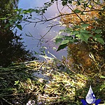
Lumley Creek
Fulford Harbour, British Columbia, Canada

- Group: Salt Spring Island Water Preservation Society (SSI WPS) : Salt Spring Island FreshWater Catalogue (SSIFWC) Project
- Lat: 48.73
- Lng: -123.437
- Waterbody Type: Creek
- Timezone: UTC
Latest photos
No photos uploaded.
Lumley Creek : RUAL Lumley Creek at sea outfall
Observed on
2020-02-20
Lumley Creek : RUAL Lumley Creek at sea outfall
Observed on
2020-02-12
Water level approx. 10cm below tip of bedrock (reference point) in centre of flow.
Lumley Creek : RUAL Lumley Creek at sea outfall
Observed on
2020-02-06
SSIFWC Admin location me update - sea outfall. Water level just above high point of reference ...
Lumley Creek : RUAL Lumley Creek at sea outfall
Observed on
2020-01-29
Water level just above high point of reference bedrock. Corrected wetted width and profile 11 S...
Lumley Creek : RUAL Lumley Creek at sea outfall
Observed on
2020-01-23
Water level approximately 10cm above reference high point of bedrock protrusion mid-stream. Cor...
Lumley Creek : RUAL Lumley Creek at sea outfall
Observed on
2020-01-16
Gauge point: tip of bedrock protuberance mid-stream at profile. Water level: 9cm below gauge p...
Lumley Creek : RUAL Lumley Creek at sea outfall
Observed on
2020-01-08
Corrected wetted width and profile 11 Sept 2020.
Lumley Creek : RUAL Lumley Creek at sea outfall
Observed on
2019-12-26
Small flow from ephemeral entering from Thorburn's this week. SSIFWC Admin location watershed u...
Lumley Creek : RUAL Lumley Creek at sea outfall
Observed on
2019-12-19
Lumley Creek : RUAL Lumley Creek at sea outfall
Observed on
2019-12-11
