Lumley Creek
Fulford Harbour, British Columbia, Canada
- Group: Salt Spring Island Water Preservation Society (SSI WPS) : Salt Spring Island FreshWater Catalogue (SSIFWC) Project
- Lat: 48.73
- Lng: -123.437
- Waterbody Type: Creek
- Timezone: UTC
Latest photos
No photos uploaded.
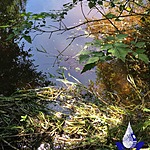
Water level approx. 10cm below tip of bedrock (reference point) in centre of flow.
SSIFWC Admin location me update - sea outfall.
Water level just above high point of reference bedrock.
Corrected wetted width and profile 11 Sept 2020.
Water level just above high point of reference bedrock.
Corrected wetted width and profile 11 Sept 2020.
Water level approximately 10cm above reference high point of bedrock protrusion mid-stream.
Corrected wetted width and profile 11 Sept 2020.
Gauge point: tip of bedrock protuberance mid-stream at profile.
Water level: 9cm below gauge point
Corrected wetted width and profile 11 Sept 2020.
Small flow from ephemeral entering from Thorburn's this week.
SSIFWC Admin location watershed update.
Corrected PH reading 11 Sept 2020.