Byram Swinging Bridge

Pearl River

Jackson, Mississippi, United States

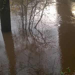
Byram Swinging Bridge connects Hinds and Rankin counties over the Pearl River. It was added to the National Register of Historic Places in 1979. Access the river from the west (Byram) side and sample just north of the bridge. River bank is sandy but hard-packed clay near the water's edge can be slippery.
Location created by
Abby Braman

Latest photos

View all photos

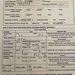
Rain in the previous 4 hours.

17 Jul 08:26 by Robert McAdory

No rain in previous 24 hours.

10 Jul 08:55 by Robert McAdory

No rain in previous 24 hours.

03 Jul 09:35 by Robert McAdory

Rain in the previous 24 hours

26 Jun 09:38 by Robert McAdory

No rain in previous 24 hours.

19 Jun 10:27 by Robert McAdory

no rain in preceding 24 hours

12 Jun 10:35 by Robert McAdory

No unusual smells or colors; no animals; a few tourists on the Swinging Bridge; current > 1 ft/sec in mid stream of river; no debris; no wind. Large eddies passing under bridge exhibited white streaks indicating mixing of something coming from upstream. Current in collection area swirling and evident but < 1 ft/sec. Partly cloudy with a little more thin cloud cover than the day before; bright sun when clouds part. No rain in last 24 hours. Continuing large discharges from upstream reservoir. Water level a few inches above yesterday, with falling stage; upstream gage was falling. Water was clear to less than a half foot. Adequate depth.

27 Jan 10:15 by Robert McAdory

No unusual smells or colors; no animals; tourists on the Swinging Bridge; current > 1 ft/sec in mid stream of river; no wind. Current in collection area swirling and evident but < 1 ft/sec. Partly cloudy with bright sun where clouds parted. No rain in last 24 hours but with large discharges from upstream; water level 10 ft or more lower than 12-30-18 observations, and the upstream gage was slowly rising. Discharge at upstream gage (Jackson gage) was over 8.7k cfs. Fist or softball size foam "balls" floating down river. No large debris. Water was clear to a half to one foot. Adequate depth.
N.B.: Coliform results should be reported as 200 and 1400 to be correct wrt number of significant figures, but I have opted to go with the AWW convention.

26 Jan 10:00 by Robert McAdory

No unusual smells or colors; no animals; a few tourists on the Swinging Bridge; dog that lives adjacent to west parking area seen in parking area and on bridge; current > 3 ft/sec in mid stream of river with debris; no wind. Current in collection area swirling and evident but < 1 ft/sec. Sky cloudy with uniform overcast. Rain of 1.22 inches in last 24 hours reported at nearby Riverbend weather station, and continuing large discharges from upstream reservoir due to heavy watershed wide rains three days earlier; water level 10 - 15 ft higher than 12-01-18 observations and 2+ ft higher than 12-29-18 observations; upstream gage was rising, and water level at collection site rose a few inches during the two hours on site 12-10-18. Water was clear to less than a half foot. Adequate depth.

30 Dec 10:00 by Robert McAdory

No unusual smells or colors; no animals; no tourists on the Swinging Bridge; dog that lives adjacent to west parking area seen in parking area; current > 3 ft/sec in mid stream of river; no wind. Current in collection area swirling and evident but < 1 ft/sec. Sky cloudy to partly cloudy. No rain in last 24 hours but with large discharges from upstream reservoir due to heavy watershed wide rains two days earlier; water level 10 - 15 ft higher than 12-01-18 observations, and the upstream gage was steady-to-slow-rise. Water was clear to a half to one foot. Adequate depth.
N.B.: Coliform results should be reported as 4100 and 17800 to be correct wrt number of significant figures, but I have opted to go with the AWW convention.

29 Dec 08:00 by Robert McAdory