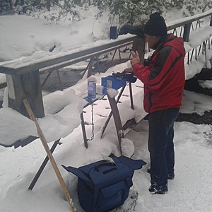
Mill Creek
Orillia, Ontario, Canada
TThis site is located just downstream of the Mill Creek Bridge.
Mill Creek is part of the Oro Creek North sub watershed of the Lake Simcoe Watershed. Mill Creek makes its way through Scout Valley, under Hwy 11, through a Provincially Significant Wetland, and then merges with "Ben's Ditch" before flowing into Lake Simcoe beside the City of Orillia Landfill.
This location is frequented by off leash dogs.
This site has been monitored by trained volunteers since 2016. No data collected in 2021.

- Group: Couchiching Conservancy : Community Science Water Monitoring Program
- Site ID: WQ64
- Lat: 44.5822913
- Lng: -79.4484043
- Waterbody Type: Stream
- Timezone: Canada/Eastern
Latest photos
Wrong titrator used for DO
Minnows were approx 3" long.
2 crayfish. Alkalinity may be suspect because of a poor seal on the titrator
Two mallards, chorus of wood frogs heard, american toad sighted and a chorus of spring peepers heard
Weather in past 48 hours: hot and humid
Weather in past 48 hours: Rain yesterday, sunny today
Sunny weather
Weather in past 48 hours: Rain, snow, thaw.
Weather: flurries. Ice approx 2.5 inches thick covering most of site.
Leopard frog and crayfish spotted 10 - 15m downstream, squirrel and chipmunk sighted.
