Black Creek
Ontario, Canada
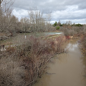
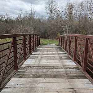
Water samples are collected using a throw-bucket off of the bridge. There is a lot of woody debris on the upstream side of the bridge, so we sample from the downstream side. There is a pond nearby, it appears to be offline (not connected to Black Creek) as the elevation is higher than the creek. There is a small parking area nearby. Access to the conservation area is free.

Location created by
Kiersten McCutcheon
- Group: Water Rangers : Lake Erie Rangers
- Site ID: Stevensville Conservation Area footbridge
- Lat: 42.9435751
- Lng: -79.0738392
- Waterbody Type: Creek
- Timezone: America/Toronto
Latest photos
View all photosObservation tests summary
Air temperature
°C
22.0
Latest
10.4
Average
Water temperature
°C
21.8
Latest
7.9
Average
Alkalinity
mg/L
40
Latest
40
Average
Hardness
mg/L
200
Latest
200
Average
Dissolved oxygen
mg/L
8.0
Latest
8.0
Average
Chloride
ppm
43.0
Latest
130.0
Average
Chlorine
ppm
0.0
Latest
0.0
Average
Conductivity
μS/cm
608
Latest
552
Average
pH (0-14)
6.4
Latest
6.4
Average
Ice On
- 2025-01-26
Ice Off
- 2025-06-29
- 2025-03-30
- 2025-03-14
- 2024-12-27


