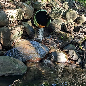
East Branch of Wagg Creek emerges from culvert WAG-E-06a High Priority
North Vancouver, British Columbia, Canada
location of WAG-E-06a using zoom on web app. A green plastic storm pipe of 0.72m inside diameter surfaces the east branch of Wagg Creek. It is the creek. This is a high energy, high flow site. Field measured GPS coordinates in NAD83 are -123.0759570, 49.32744605 in Long and Lat, or UTM 494,481E, 5,463,860N
this site was active under the "Salt Project" and called 20th St Outfall

- Site ID: WAG-E-06a
- Lat: 49.3281288
- Lng: -123.0763364
- Waterbody Type: Unknown
- Timezone: America/Vancouver
Latest photos
View all photosWith testers Susan G. and Finn A.
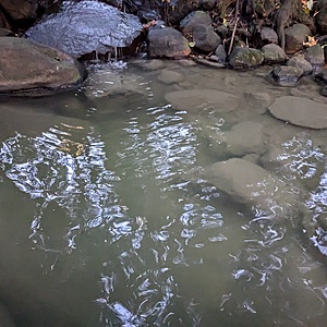
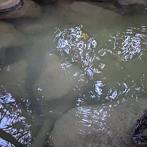
Water had slight cloudiness, but secchi disk clearly visible in tube, turbidity <14 NTU.
Very high energy flow. Grab sample collected ~10m from concrete slab discharge point - unable to approach pipe due to safety. Lower conductivity due to increased water volume. This location more turbid than other locations sampled in same time period. 6PPD-Q sample collected.
Grab sample collected in a cup from discharge point at bottom of concrete slab in the plunge pool.
Conductivity 326 uS at 18.1 deg C.
Water column completely clear - 14 NTU (unable to enter "<" symbol).
YSI probe sampled the east side of plunge pool. YSI readings: Water temp: 16.8 deg C; DO: 10mg/l; Spec Cond: 345; Cond: 305; ph: 7.29; TSS: 124; Turbidity: 5797 NTU
Turbid water. Gray foam on water. Slight smell of sewage.
Water is gray, high turbidity. Visibility is about half a metre foam accumulating. Suspended sediments. Slight smell of soap. BC metre has water temp reading of 8.6°C TDS 250 ppm.
Good volume of water. Slightly cloudy water column.
For comparison, measurement also taken in mainstem. Conducivity: 538, TDS: 267/
At the time the sample was taken, it had just started to rain in the past hour after approx 2 days of no rain.
High turbidity; water appeared gray/black; visibility <1 cm
water relatively clear, .75m visibility. currently only a light drizzle but water still discharging forcefully, splashing about .5 m height when it hits riprap
Water is murky with brownish green cast, very turbid
Water is coming out of the pipe but less water than usual. Water is murky, smells like metal or chemicals.
Saw water strider bugs.


