
East Branch of Wagg Creek emerges from culvert WAG-E-06a High Priority
North Vancouver, British Columbia, Canada
location of WAG-E-06a using zoom on web app. A green plastic storm pipe of 0.72m inside diameter surfaces the east branch of Wagg Creek. It is the creek. This is a high energy, high flow site. Field measured GPS coordinates in NAD83 are -123.0759570, 49.32744605 in Long and Lat, or UTM 494,481E, 5,463,860N
this site was active under the "Salt Project" and called 20th St Outfall

Location created by
Paul Lhotka
- Site ID: WAG-E-06a
- Lat: 49.3281288
- Lng: -123.0763364
- Waterbody Type: Unknown
- Timezone: America/Vancouver
Latest photos


Observations summary
Observation tests summary
Air temperature
°C
17.1
Latest
14.5
Average
Water temperature
°C
16.1
Latest
13.6
Average
Alkalinity
mg/L
20
Latest
29
Average
Hardness
mg/L
50
Latest
14
Average
Chlorine
ppm
0.0
Latest
0.0
Average
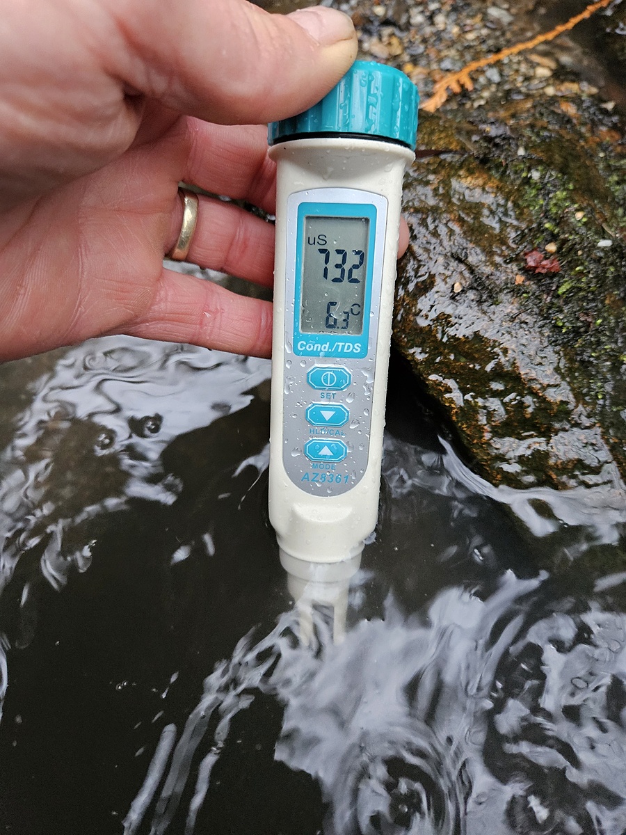
Conductivity
μS/cm
275
Latest
258
Average
pH (0-14)
7.4
Latest
7.2
Average
Total dissolved solids
ppm
361.0
Latest
361.0
Average
Dissolved oxygen
mg/L
8.0
Latest
8.0
Average
Turbidity
NTU
14.0
Latest
16.3
Average