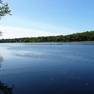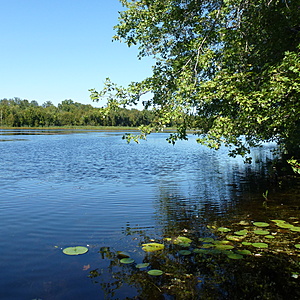
Upper Napanee River (NE of Colebrook Dam)
Ontario, Canada
Upper Napanee River NE of the Colebrook Dam where the river is at its widest.
The water moves very slowly in this area as it backs up behind the Colebrook Dam.

- Group: Friends of the Napanee (Ontario, Canada)
- Lat: 44.3969953
- Lng: -76.7642212
- Waterbody Type: River
- Timezone: America/Toronto
Latest photos
View all photosSunny, clear day and no winds.
Water is down to normal Fall levels and moving at its normal slow rate.
Beautiful late Summer day and perfectly clear skies. The readings have been relatively consistent throughout this Summer (with the high level of rainfall) in this stretch of the Upper Napanee.
Beautiful day for photos as you can see.
The water is still higher than most Summers and running its "normal very slow" (because this is the widest section of the Upper Napanee).
Hot and humid today with partial cloud cover. Noticeable variance in air temperature compared to downstream - about 5 C cooler. Given the high volume of rain two weeks ago, the only major surprise was the much lower TH level - 75 compared to 150 two weeks ago.
Overcast morning. The duckweed has started to form along the shoreline.
No wildlife observed and very few dragonflies compared to normal at this time of year.
pH appears higher in this area than all other areas along the other test sites. The norm is around 7.0-7.5.
All deciduous trees in this area compared to lower downstream where the riparian zone is primarily coniferous.
Water moves very slowly in this area.

