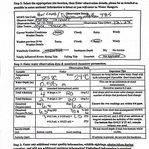
Bear Creek
Tishomingo, Mississippi, United States
Bear Creek runs through TIshomingo State Park. It's classification is Fish and Wildlife. Landuse in the area is primarily forrested land, but also includes agricultural land and pastureland. Bear Creek has a sandy bottom, but also contains gravel and boulders. <50% of the waterbody itself is shaded by trees and shrubs, and the banks are completely covered by vegetation. The waterbody is used for fishing and canoeing. Physical barriers to water movement include rocks and fallen trees in places.

Location created by
Katherine Talbert
- Group: Mississippi State University : Mississippi Water Stewards
- Lat: 34.6065576
- Lng: -88.1775784
- Waterbody Type: Creek
- Timezone: America/Chicago
Latest photos
View all photosObservations summary
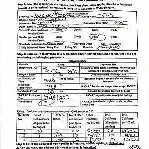
Observation tests summary
Air temperature
°C
22.0
Latest
25.6
Average
Water temperature
°C
15.0
Latest
23.1
Average
Alkalinity
mg/L
35
Latest
29
Average
Hardness
mg/L
30
Latest
30
Average
Dissolved oxygen
mg/L
8.2
Latest
6.5
Average
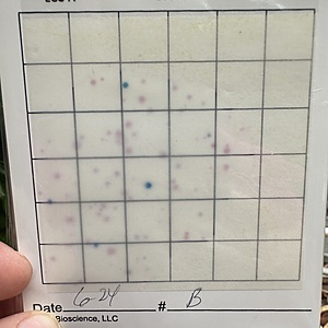
Total coliform
cfu per 100mL
1800
Latest
1492
Average
Water depth
m
0.1
Latest
0.3
Average
Dissolved oxygen
%
80.9
Latest
75.4
Average
Incubation temperature
°C
36.0
Latest
36.0
Average
Turbidity
JTU
2
Latest
2
Average
E.coli
cfu per 100mL
233
Latest
100
Average
Other coliform
cfu per 100mL
1567
Latest
1392
Average
Incubation time
(hours)
24.0
Latest
22.8
Average
pH (0-14)
8.0
Latest
7.8
Average

