End of Porters River
Louisiana, United States
Porters river is approximately 2.5 - 3 miles long. It is fed from the West Pearl River just below Interstate 59 in Pearl River, Louisiana. Its water returns into the West Pearl River.
The water flow is controlled by the West Pearl River and can be monitored from the National Water Prediction Service (NWPS) web site ID #NWSLI: PERL1, Reach ID: 15714333
Permanent residents, primitive camps, and boat houses can be found along the river but mostly you will find wooded banks.
Although the water is fed from the WPR there is drainage from residential/neighborhood, small business, light industry and woodland.

Location created by
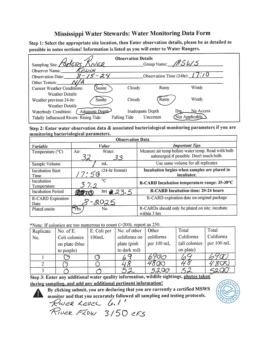
Kevin Olsen
- Group: Mississippi State University : Mississippi Water Stewards
- Lat: 30.3340834
- Lng: -89.7085619
- Waterbody Type: River
- Timezone: America/Chicago
Latest photos


End of Porters River : Porters River
Observed on
2024-08-23
End of Porters River : Porters River
Observed on
2024-08-17
End of Porters River : Porters River
Observed on
2024-08-09
End of Porters River : Porters River
Observed on
2024-08-02
End of Porters River : Porters River
Observed on
2024-07-26
End of Porters River : Porters River
Observed on
2024-07-12
R-Card Coliform indications easier to identify by Increased incubation temperature closer to uppe...
End of Porters River : Porters River
Observed on
2024-06-28
End of Porters River : Porters River
Observed on
2024-06-21
End of Porters River : Porters River
Observed on
2024-06-13
R-Card E. Coli and other coliform indications very faint.