North Wey at Alton
Alton, Hampshire, United Kingdom
Alton

- Group: River Wey Trust : Alton Hub
- Site ID: thighs.dragons.rooftop
- Lat: 51.1496251
- Lng: -0.9834003
- Waterbody Type: River
- Timezone: UTC
Latest photos
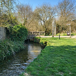
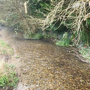
View all photosRiver very low and slow moving after dry weather. Clear in test region but sludgy in places downstream.
Saw a wagtail, I think pied but didn't get a good enough look to be sure. Also goldfinches.
Very low water, river bed showing in many places. Only about 5cm deep where I got the test water.
Shoal of minnows, fleeing under the bridge whenever anyone got close. I have heard that someone had put traps under the bridge and quite a few dead minnows were found in them.
Saw a small shoal of fish that seem to be living under the bridge. Couldn't see them well enough to identify them but they ranged in size from tiny to 3 or 4 inches long. Tried to photograph them but they fled as soon as I tried to focus.
No litter in the testing area, but there were a few cans and bottles upstream of the bridge. I cleared most but because the river is blocked under the bridge the water is deep there and I couldn't get to a couple of bits.
Quite a lot of flowers from the trees in the river. Also several dogs.
Chiffchaffs are back.
Nuthatch calling, but couldn't see it. Someone passing had seen a kingfisher earlier.
Some plants lying in the river, I assume swept in from the banks.
Blockage by bridge has been cleared.
Saw a Little Egret, and a man said he saw a kingfisher recently.
Lot of autumn leaves in river
Still partial blockage under the bridge upstream of test site
Still partially blocked under the bridge upstream of test point. There's sludge coming through blockage but water is clear downstream at test area.
Autumn leaves are falling into river.


