Westbrook Rd : Pearl River
Brandon, Mississippi, United States

- Observed on: Wed, 16 Jun 2021 11:00:00 -0500
- Testers Will McDearman
-
Associated with:
Mississippi State University : Mississippi Water Stewards - Lat: 32.3650645
- Lng: -90.1007438
Observation report
See trends at this locationWater quality tests
✓ Quality checked by Water Rangers What's this?
Microplastics
Weather
Latest photos
Notes
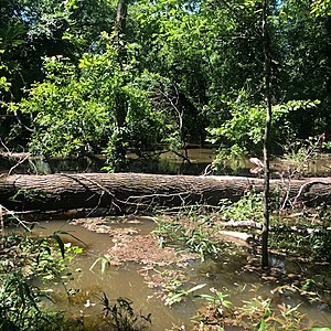
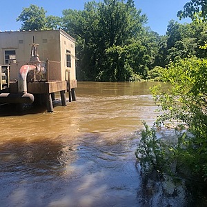
Pearl River is at flood stage from heavy rain and increased discharge from upstream reservoir spillway dam. Gauge is 33 feet at Hwy 25 Lakeland Dr. Gauge and 28.7 feet at Jackson Gauge, both downtream. Standard sample site at sandbar was not accessible due to overbank and backwater flooding covering the trail thru bottomland hardwood forest. However, I took this sample at a nearby location 1000 feet upstream on a high bank in same river reach and where no other intermittent, perennial or other streams entered and the adjacent habitat is all forested. I consider this as a comparable sample to the usual site 1000 feet downstream. This sample was collected downstream from the Lake Hico water intake structure, which was not operating. River was high, swift, and muddy.


