River Wey
Blacknest, Surrey, United Kingdom
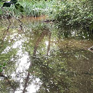
Testing site on west bank of river adjacent to footbridge. Slow moving water upstream of Frensham Mill.

- Group: River Wey Trust : South Wey Hub
- Site ID: GB106039017780/T010/SEQ230
- Lat: 51.1585423
- Lng: -0.807023
- Waterbody Type: River
- Timezone: Europe/London
Latest photos
View all photosNo visible wildlife /no visible water based insects on the surface/just below/ just above
The water level here on the river Wey has noticeably dropped over the past 12 months.
Despite having had high levels of rainfall over the past year , the river level is consistently about half a metre lower - even after heavy rain. So much so that I've been unable to reach the water level from my usual testing spot.
I note that the banks are showing a considerable concerning erosion with the roots of trees near to the river now protruding out of the exposed bank sides.
Tree stability in this area has been undermined and I have observed many trees that had been lining the river banks have fallen over or collapsed into the river.
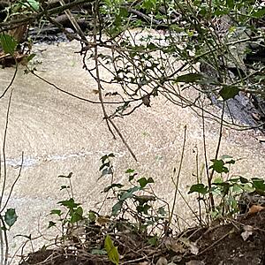
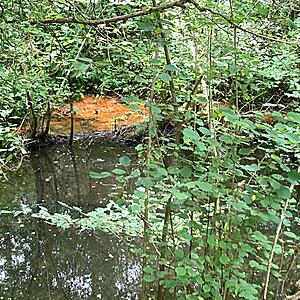
Further upstream of this testing spot , I observed an area of bright orange on the water surface - looking like pollution & not a natural- forming bloom. I couldn't get close enough to take a detailed picture being on the opposite side of the river with no public access but photo is included of this & another area of thick white foam.
there was no evidence of any wildlife - including no water surface/ flying insects
We were unable to observe any insect/mammal/bird life in or in the edges of the river. It was notable that the water opacity changed significantly in this stretch after the other branch of the Wey joined.


