Hog Creek Tributary
Brandon, Mississippi, United States
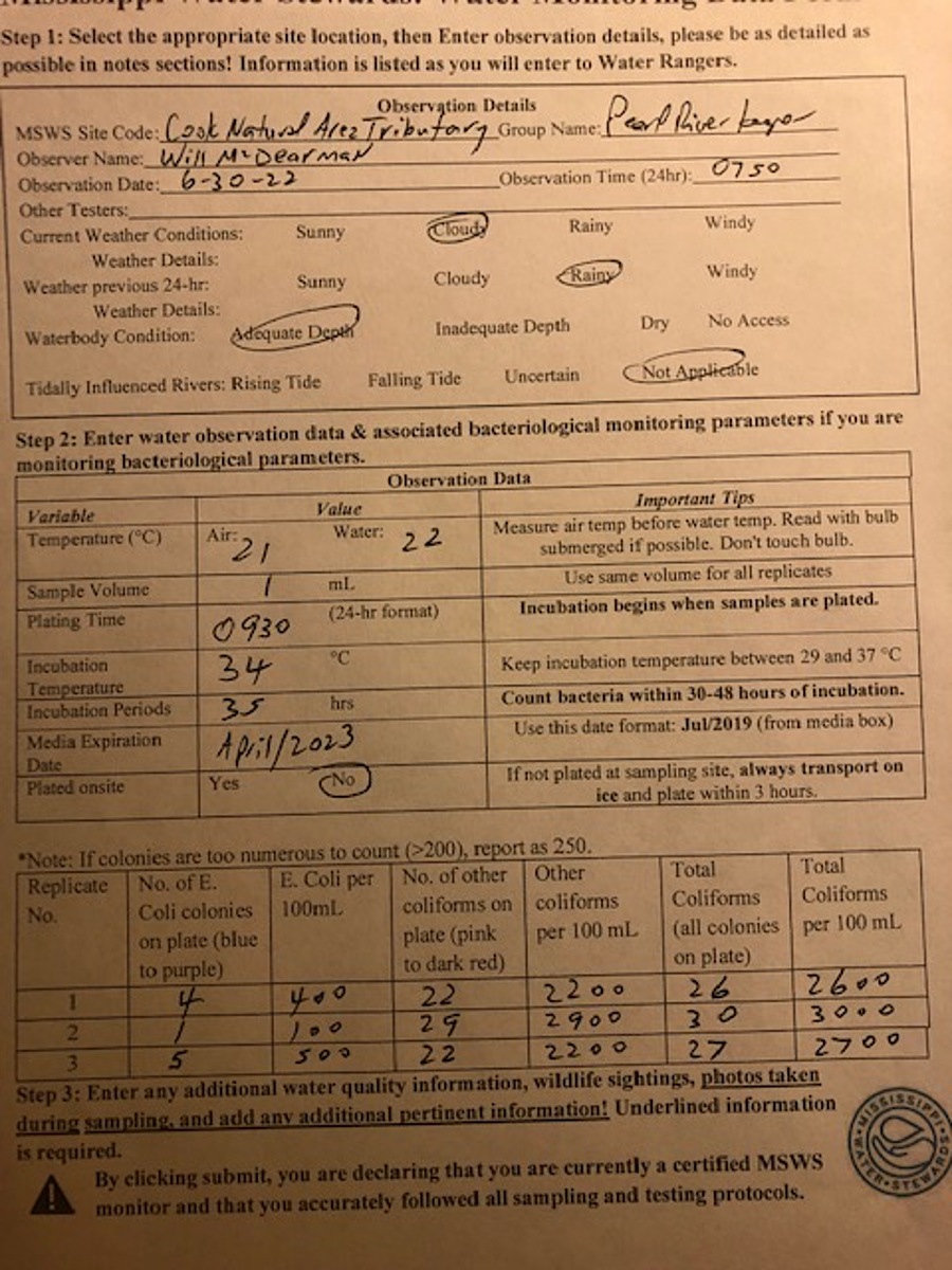
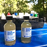
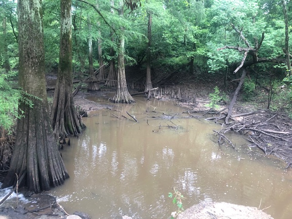
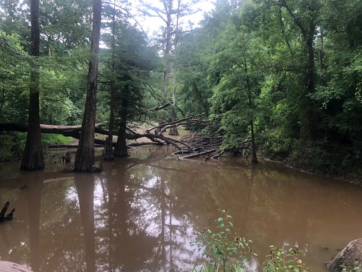
This Hog Creek watershed tributary (unnamed tributary) test site is in the Fannye A. Cooke Natural Area (FACNA) managed by Wildlife Mississippi with restricted access. Wildlife Mississippi for 2022 currently has granted permission only to Will McDearman with Pearl Riverkeepers (PRK) for access and testing. Wildlife Mississippi in the future may entertain requests for permission to other PRK volunteers, but that future point has not yet been reached. Coordination with Libby Hartfield, Wildlife Mississippi Education Coordinator, is essential to understand when conditions may be appropriate for additional requests to James Cummins, Executive Director. Access requires the gate padlock combination at the main gate and one additional side gate. The main gate is located on Liberty Road 0.34 miles from the intersection of Lakeland Drive. On Liberty Road from Lakeland Drive, turn left onto gravel drive to the gate. Unlock padlock with the combination, pass, and lock the main gate before continuing. On gravel road continue 0.36 miles to the first road on the left with gate. Unlock padlock on gate, pass, and relock the gate. Proceed down gravel road that, at 0.63 miles, curves to the right and will pass a gravel parking area on the right. The road will then curve to the left and descend to a lower Pearl River floodplain terrace. Cross a drainage over roadfill with metal culverts and continue. At 1.08 miles from the side gate entrance there is a second tributary crossing under roadfill with two metal culverts. This is the Hog Creek watershed tributary test site. Park on the side of the gravel road or park in a grassy open area on the right before crossing the tributary. The open grassy area may be muddy or soft and unsuitable for parking. The dirt-fill tributary crossing is covered with cement and asphalt. Carefully walk down the cement-asphalt bank to the downstream side to test discharge at or near the culverts. Alternatively, walk down the left downstream dirt bank to the edge of the tributary. Boots may be needed if muddy and to walk under cypress trees through cypress knees to the edge of the water. At lower tributary water levels there may not be any discharge through the metal culverts downstream where the roadfill and position of the culverts will damn and block flow. A decision is required in this low water condition whether to test on the upstream backwater or downstream side. From the test site, this unnamed tributary runs 0.17 miles to the Pearl River.
Location created by
Abby Braman
- Group: Mississippi State University : Mississippi Water Stewards
- Lat: 32.3489505
- Lng: -90.1071811
- Waterbody Type: Unknown
- Timezone: America/Chicago
Latest photos
There are currently no issues at this location.