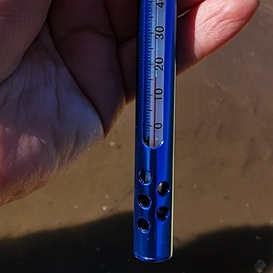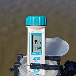
South Saskatchewan River
Saskatchewan, Canada
This is a popular spot for paddlers to begin a 3 hour paddle back into Saskatoon, SK. The water depth can vary considerable, depending on the flow released by the Gardiner Dam. It is a sandy spot located between Poplar Bluffs and Cranberry Flats, just north west of Wilson Island which is in the middle of the river at this location. The water flows on both sides of Wilson Island.

- Group: University of Regina : Citizen Science
- Lat: 52.0281056
- Lng: -106.7134666
- Waterbody Type: River
- Timezone: America/Regina
Latest photos
View all photosSouth Saskatchewan River : Poplar Bluffs Conservation Area
Observed on
2021-08-29
South Saskatchewan River : Poplar Bluffs Conservation Area
Observed on
2021-07-25
South Saskatchewan River : Poplar Bluffs Conservation Area
Observed on
2021-07-17
South Saskatchewan River : Poplar Bluffs Conservation Area
Observed on
2021-07-10
South Saskatchewan River : Poplar Bluffs Conservation Area
Observed on
2021-07-07
South Saskatchewan River : Poplar Bluffs Conservation Area
Observed on
2021-06-27
South Saskatchewan River : Poplar Bluffs Conservation Area
Observed on
2021-06-12
South Saskatchewan River : Poplar Bluffs Conservation Area
Observed on
2021-06-05
South Saskatchewan River : Poplar Bluffs Conservation Area
Observed on
2021-05-30
The water was very shallow and I was unable to access a deeper spot today.


