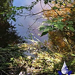
Ruby Alton Creek
Fulford Harbour, British Columbia, Canada

Location created by
SSIFWC Project
- Group: Salt Spring Island Water Preservation Society (SSI WPS) : Salt Spring Island FreshWater Catalogue (SSIFWC) Project
- Lat: 48.752
- Lng: -123.442
- Waterbody Type: Creek
- Timezone: UTC
Latest photos
No photos uploaded.
Ruby Alton Creek : RUAL Ruby Alton Ck outfall
Observed on
2021-03-13
Ruby Alton Creek : RUAL Ruby Alton Ck outfall
Observed on
2021-02-26
Bucket measurement: Right side: 4.25,4.16,3.46@6L Left side: 4.9,4.6,4.4@6L
Ruby Alton Creek : RUAL Ruby Alton Ck outfall
Observed on
2021-02-12
Ruby Alton Creek : RUAL Ruby Alton Ck outfall
Observed on
2021-01-29
Ruby Alton Creek : RUAL Ruby Alton Ck outfall
Observed on
2021-01-23
Ruby Alton Creek : RUAL Ruby Alton Ck outfall
Observed on
2020-12-12
Ruby Alton Creek : RUAL Ruby Alton Ck outfall
Observed on
2020-12-05
Ruby Alton Creek : RUAL Ruby Alton Ck outfall
Observed on
2020-11-29
Ruby Alton Creek : RUAL Ruby Alton Ck outfall
Observed on
2020-11-22
Summer flow entered from averages from 2 sides of waterfall = .68 L/sec
Ruby Alton Creek : RUAL Ruby Alton Ck outfall
Observed on
2020-11-15
