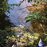
Ford Lake Outfall Creek
Fulford Harbour, British Columbia, Canada

Location created by
SSIFWC Project
- Group: Salt Spring Island Water Preservation Society (SSI WPS) : Salt Spring Island FreshWater Catalogue (SSIFWC) Project
- Lat: 48.795
- Lng: -123.478
- Waterbody Type: Creek
- Timezone: UTC
Latest photos
No photos uploaded.
whirlpool still prominent. Water is 20 centimetres above culvert on u/s side. Stream still flooding far over banks so bo wetted width or culvert measurement.
Extensive field flooding beside stream coming from lake. Water almost to top of culvert—Depth estimated. Large log bobbing streamside-future problem?
Stream wetted width was 5.38 M across at culvert. Culvert seems crushed a bit.
SSIFWC Admin Other location name converted to regular FLCKFord Lk Outfall u/s CMP
