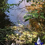
Lee Creek
Fulford Harbour, British Columbia, Canada

Location created by
SSIFWC Project
- Group: Salt Spring Island Water Preservation Society (SSI WPS) : Salt Spring Island FreshWater Catalogue (SSIFWC) Project
- Lat: 48.791
- Lng: -123.505
- Waterbody Type: Creek
- Timezone: UTC
Latest photos
No photos uploaded.
We could not take flow measurements at this location due to lower water levels and debris clogging the culvert - may need to return to other location for flow measurements.
SSIFWC Admin Locn me update 20200428
SSIFWC Admin location me update, Oakton no. (200) added in
Lee Creek wetted width ca 2 upstream
