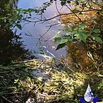
Ribbon Creek
Fulford Harbour, British Columbia, Canada

Location created by
SSIFWC Project
- Group: Salt Spring Island Water Preservation Society (SSI WPS) : Salt Spring Island FreshWater Catalogue (SSIFWC) Project
- Lat: 48.729
- Lng: -123.452
- Waterbody Type: Creek
- Timezone: UTC
Latest photos
No photos uploaded.
Stream just barely flowing again, after torrential rains overnight and today. Water collected in small pool in bedrock, flowing through plastic pipe then disappearing into softer gravel of stream bed.
Relocated plastic pipe to capture accurate flow in bedrock pool further U/S from falls.
SSIFWC Admin locn me update ck 2 creek 20200425
Updated GPS coordi tes May 27, 2020
Changed from 'culvert' to 'complex'; added profile, sq.cm and calculated flow 07sept20.
