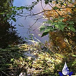
South Canyon Creek
Fulford Harbour, British Columbia, Canada

Location created by
SSIFWC Project
- Group: Salt Spring Island Water Preservation Society (SSI WPS) : Salt Spring Island FreshWater Catalogue (SSIFWC) Project
- Lat: 48.729
- Lng: -123.452
- Waterbody Type: Creek
- Timezone: UTC
Latest photos
No photos uploaded.
SSIFWC Admin locn me update ck 2 creek 20200425
Updated GPS coordi tes May 28, 2020.
Updated profile and flow 11Sept using profile documented Aug. 2020.
Established two gauge points for summertime profile measurements:
1) high point of large rock on west edge of profile; 2) smaller submerged point toward mid-stream.
Water level: 25cm below gauge point 1, and 8cm above gauge point 2.
Updated profile and flow 11Sept using stream bed profile documented Aug. 2020.
