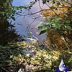
South Canyon Creek
Fulford Harbour, British Columbia, Canada

- Group: Salt Spring Island Water Preservation Society (SSI WPS) : Salt Spring Island FreshWater Catalogue (SSIFWC) Project
- Lat: 48.728
- Lng: -123.451
- Waterbody Type: Creek
- Timezone: UTC
Latest photos
No photos uploaded.
Greatly increased flow following torrential rains overnight and today, running over and through the plastic pipe, rendering it useless, so I have used timer and float to measure flow.
Increase in flow from previous week, due to small rain overnight (approx. 1mm).
Installed staff gauge, current water level at 5cm above zero. Zero on the gauge is approximately 15cm above maximum depth.
Top of gauge (100cm) is approximately 50cm below bottom of cedar log hanging over the creek, which is the top edge of the documented creek profile.
Added GPS coordi tes 11 Sept 2020.
Added GPS coordi tes 11 Sept 2020.
New site flowing over bedrock, installed plastic pipe to capture flow. Small amount of flow is lost, however, emerging through gravel and rock slightly downstream, and evidenced by reduced litres/sec documented at pipe (compared to established site above Ribbon Falls).
Still has potential for winter season monitoring, so I took a profile.
Added GPS coordi tes 11 Sept 2020.
