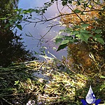
Madrona Creek
British Columbia, Canada
Location created by
SSIFWC Project
- Group: Salt Spring Island Water Preservation Society (SSI WPS) : Salt Spring Island FreshWater Catalogue (SSIFWC) Project
- Lat: 48.865
- Lng: -123.499
- Waterbody Type: Creek
- Timezone: UTC
Latest photos
No photos uploaded.
Was u ble to get anything to move to offer a flow indicator/ first attempt with cedar needles gave me a 9 min reading / then none of the small fragments would move after this.
This data set does not include Creek profile - was not given these questions to provide that data.
Culvert data was requested- this is not my culvert site
Just did a correction of the above using the “complex” profile option