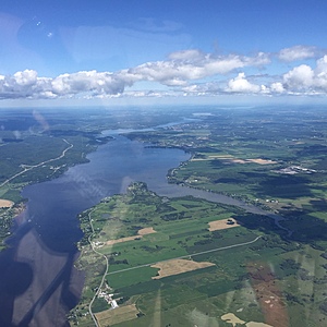
Ottawa River
Ontario, Canada
Main stream of Ottawa River off La Rochelle Camping. Open water; ~20' depth.
N45.6289 W-74.7047

Location created by
David Wilson
- Group: Ottawa Riverkeeper : Riverwatch
- Lat: 45.6287597
- Lng: -74.7057001
- Waterbody Type: River
- Timezone: America/Toronto
Latest photos
Campground on Pt. de Laviolette (LaRochelle, approx 30 spaces) completely removed (suspect coming McMansion!)
Rec. boating, gliders.
Calm (but wakes)
Cormorant seen earlier in day.
Boats active; dev on shoreline nearby.
Possible cormorant (distant)
