Mouth of Madawaska River
Arnprior, Ontario, Canada
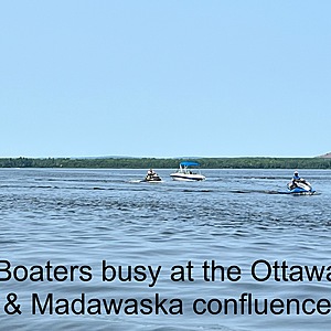
Water is fairly fast moving along shore of town of Arnprior and running alongside town effluence pipe. Town pipe dumps contents into Ottawa approximately 300 meters from the north west land point. Town filtration centre, manicured land, boat launch (with gas pumps), town marina and walking path run along northwest side of river (above pipe line). A supervised town beach runs along the curve and shoreline on Ottawa River. Shoreline on south east side of River includes a mix of natural shoreline, docks, yacht club and housing. Some rocky areas but all well marked. Busy boating area.

- Group: Ottawa Riverkeeper : Riverwatch
- Lat: 45.4431247
- Lng: -76.3491762
- Waterbody Type: River
- Timezone: America/Toronto
Latest photos
View all photosMouth of Madawaska River : Madawaska at Ottawa rivers
Observed on
2014-08-22
80% cloud cover; humid Secchi depth reading of 21.25 meters changed to 2.125 meters by admin (...
Mouth of Madawaska River : Madawaska at Ottawa rivers
Observed on
2014-07-22
60% cloud; humid. Dry Secchi depth reading of 26.95 meters changed to 2.695 meters by admin (j...
Mouth of Madawaska River : Madawaska at Ottawa rivers
Observed on
2014-06-25
high water but not as noticable as Bonnechere; possible malfunction of DO probe (3.4 is uncharact...
Mouth of Madawaska River : Madawaska at Ottawa rivers
Observed on
2014-06-22
secchi at 20 degrees.good flow.
Mouth of Madawaska River : Madawaska at Ottawa rivers
Observed on
2014-05-24
Secchi angle 20 degrees. fast flow. brown streaked foam on surface.


