Ottawa River
Quebec, Canada
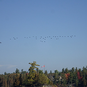
Bristol, Quebec. South of Flag Island. Not part of main channel. Usually slower moving water. Rocky shoreline and shallow rocky areas around Flag Island. It is possible to navigate close to and around the two islands with a kayak. (Coordinates - N 45 31 17.25; W 76 28 26.53)

- Group: Ottawa Riverkeeper : Riverwatch
- Lat: 45.5216387
- Lng: -76.473577
- Waterbody Type: River
- Timezone: America/Toronto
Latest photos
View all photosOttawa River : Bristol - South of Flag Island
Observed on
2017-05-27
Riverwatcher (monthly testing) (1:30pm) Weather in past 24 hrs - light rainfall Current weathe...
Ottawa River : Bristol - South of Flag Island
Observed on
2016-09-24
GPS reading: N45.51958; W076.47330 Investigators: Jennifer Haughton, Deborah Powell Weather in ...
Ottawa River : Bristol - South of Flag Island
Observed on
2016-08-29
Date: August 29, 2016 Investigators - Deborah Powell, Virginia MacLatchy, Jennifer Haughton GPS...
Ottawa River : Bristol - South of Flag Island
Observed on
2016-07-30
Investigators: Deb Powell, Virginia MacLatchy, Peter Haughton, Jennifer Haughton Water Quality T...
Ottawa River : Bristol - South of Flag Island
Observed on
2016-06-24
Clear/Partly Cloudy over past 24 hours. Currently very sunny out (hardly any clouds), and very ca...
Ottawa River : Bristol - South of Flag Island
Observed on
2016-05-28
Investigators: Deb Powell, Jennifer and Peter Haughton pH was measured using strip that expired ...


