Wyndsor Creek
Ontario, Canada
WC = Wyndsor Creek
B4 = Before
MWMC = Meeting With McVeigh Creek
This location is meant to isolate both creeks and demonstrate their individual water qualities.
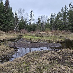
There is minimal to no flow in areas of this creek due to beaver damming.

Location created by
Ty Hourtovenko
- Group: Missanabie Cree First Nation : Dog Lake Head Waters Monitoring Program
- Site ID: WC-B4-MWMC
- Lat: 48.2677514
- Lng: -84.5268345
- Waterbody Type: Creek
- Timezone: America/Toronto
Latest photos
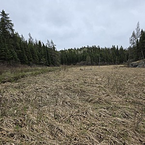
View all photosSample taken in a wetland portion before the creek merges with the McVeigh Creek. Flow is minimal and almost not visibly moving.
There is no orange staining in the creek or nearby features or the banks.
The creek is wide and difficult to cross

