Ottawa River
Quyon, Ontario, Canada
Moving water, near the Quyon Ferry

Location created by
The Crouchman Family
- Group: The Crouchman Family
- Lat: 45.5121814
- Lng: -76.215291
- Waterbody Type: River
- Timezone: America/Toronto
Latest photos
Warm, sunny day.
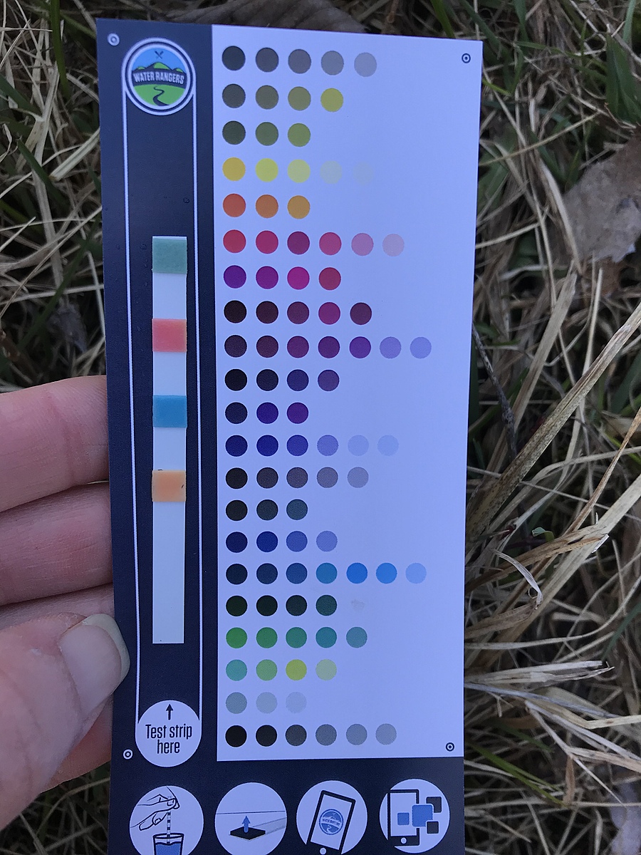
FAC 0
TCl 1
Alk 120
pH 7.2
TH 100
CyA 0
Day after heavy rain. Windy and warm.
CyA 0
TH 100
pH 6.8
Alk 40
TCl 1
FAC 0
Overcast, rain clouds heavy and ready to open up.
Shoreline slowly receding, bubbling could be heard near shoreline but we could not locate the source. Two frogs jumped off a lot and into the water when we got near to test.
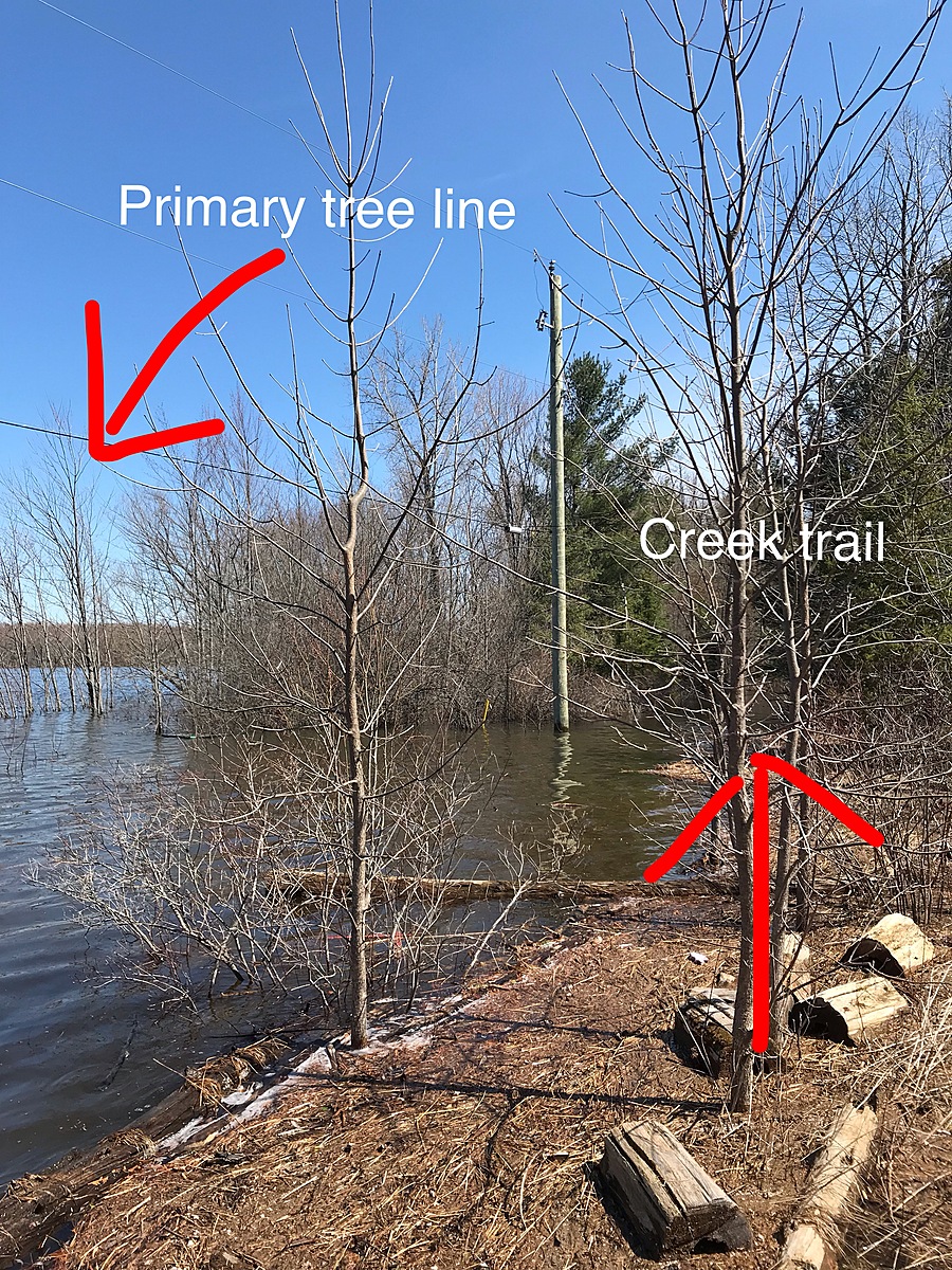
Sunny, windy day. River has breached primary tree line, washed out a trail to a creek, and submerged a hydro pole. No structures are near the river to be flooded.
Forgot to take picture of alkalinity test against the reading instrument.
Conducted side by side alkalinity tests using last year’s pH strips and this year’s pollution strips. Significant variation noted for alkalinity and pH last vs this year instruments (alk: 40 vs 120; pH: 6.8 vs 8.4).
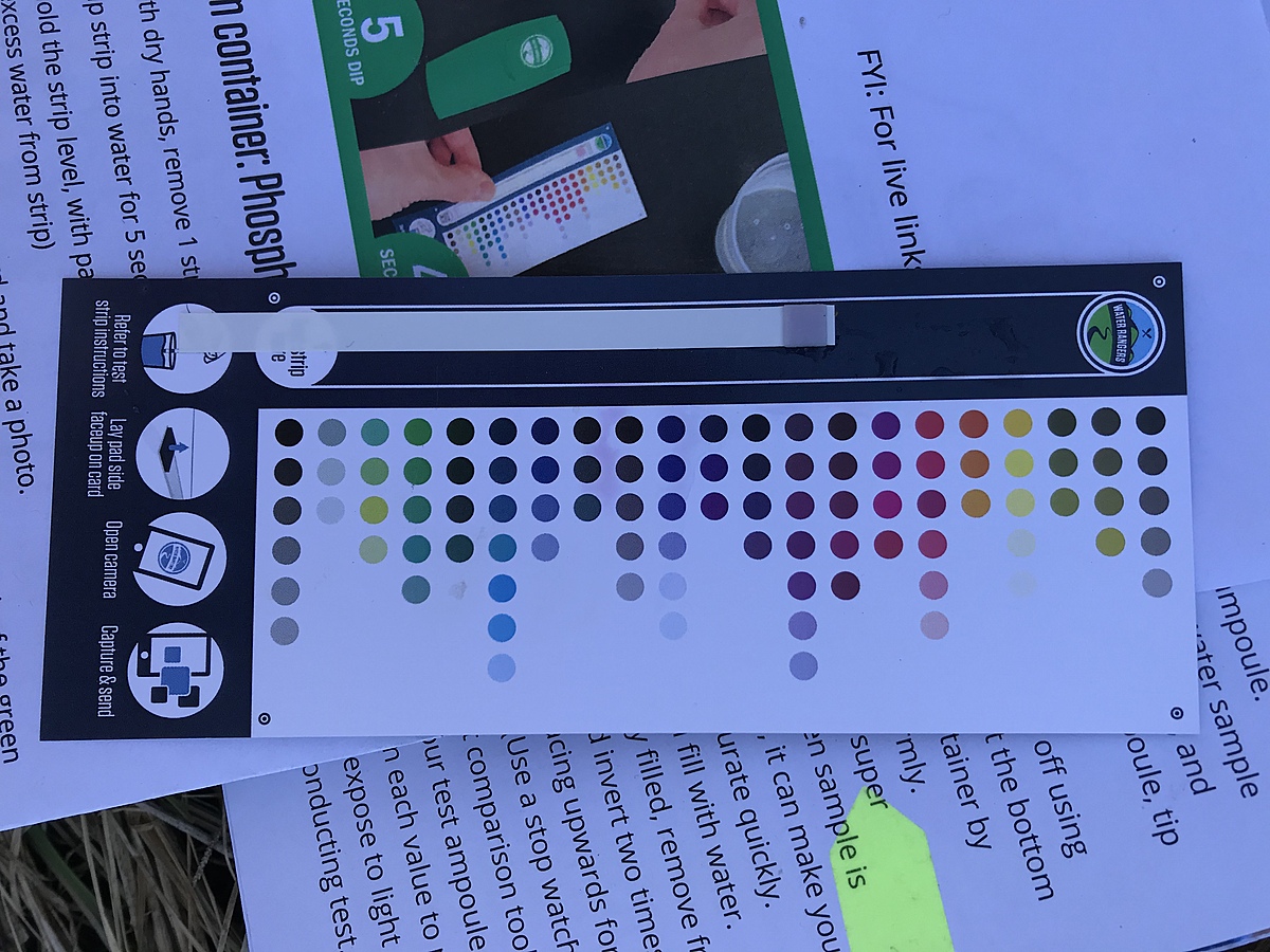
Phosphates between 15-30. Chose midline.
First weekend that the ice has finally melted from the shoreline at this location. Water is noticeably green.
At testing, overcast, but not raining. Only storm testing today.
Bird song, ants, tree fungi evident.
Last 24-48h, rainfall warning in effect, rising water levels, flood warnings in effect, communities have been preparing with sand bags since Wednesday.