
Pearl River
Lena, Mississippi, United States
Boat launch, camping, picnic areas within well maintained park. Sandbar 1/4 mile upstream used for swimming. Rural area with scattered houses. Abundant wildlife.
Location created by
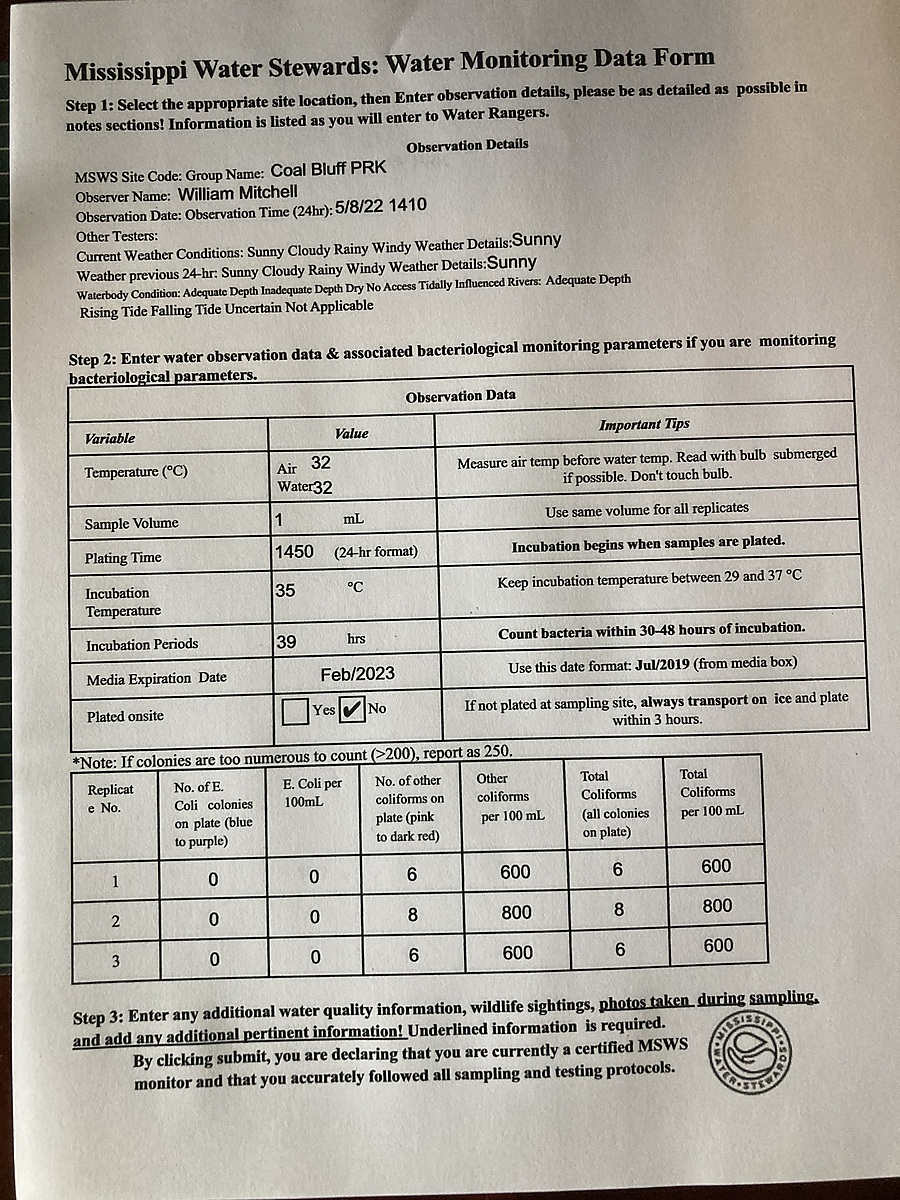
William W Mitchell
- Group: Mississippi State University : Mississippi Water Stewards
- Site ID: CB
- Lat: 32.5897433
- Lng: -89.7805524
- Waterbody Type: River
- Timezone: America/Chicago
Latest photos

Pearl River Valley Water District workers were on site with multiple trucks and heavy machinery.
There was what appeared to be sludge (possible run-off/dumping from equipment?) in the water by the dock.
There was a sign indicating that the boat ramp was closed - presumably for safety reasons related to construction, as there was rebar sticking out of the concrete at ground level by the dock.
Area around boat launch dredged. No factor in sampling.
Higher water level may have contributed to E. coli high counts
Corrected DO entry to reflect data sheet. Mark Hill 8-21-25
High count of "other" coliforms possibly due to hundreds of dead Mayflies floating in the water test area.
New floating pier installed at boat ramp.
R-Card
Water clearest I've ever seen!
River stage is high for this time of year due to above average rainfall. River flow observed as above average. Official flow is from downstream at Ratliff Ferry gauge.
River at flood stage.