Mckay Creek
Ontario, Canada
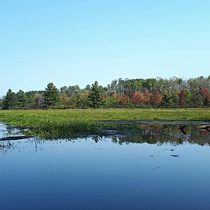
This part of Mckay Creek goes through a wetland.

- Group: Algonquin College Students
- Lat: 45.8108594
- Lng: -77.3845007
- Waterbody Type: Creek
- Timezone: America/Toronto
Latest photos
View all photosSky:Sunny, clear skies
Wind: 7Km/h
Humidity: 88%
Pressure: 101.6 kPa
---------------------
Elevation: 205m
Coordinates:
18T 0314738
5075803
---------------------
Total Dissolved Solids: 20ppm
---------------------
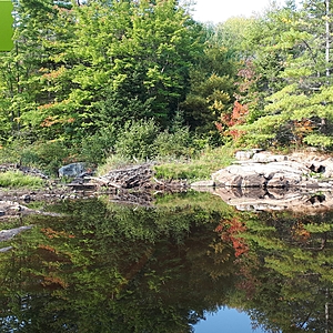
The substrate of the creek is silt in this location. There is a large wetland the creek flows through. There is some garbage around the area (for example: cans near the trail, car tire, some metal). The dominant tree species around the creek is white pine. The water is the lower than usual.
---------------------
Plants:
White pine
White Spruce
Animals:
Raccoon (seen tracks)
Great Blue Heron (seen Tracks)
Pileated Woodpecker (heard it's wuk call)
Mallards (2 were in the water)
Ruffed Grouse (seen tracks)
Eastern Chipmunks


