Stormwater pipe discharge
North Vancouver, British Columbia, Canada
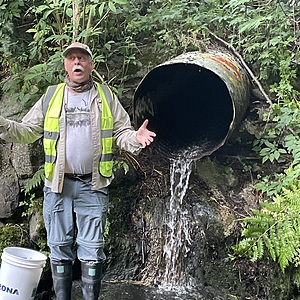
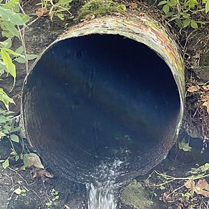
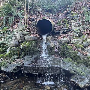
location of WAG-E-01 using zoom on web app. This is where a metal corrugated storm pipe of 0.8m inside diameter surfaces and flows into Wagg Creek from the east side, just above the start of the box culvert that carries Wagg under Keith Road. Water falls onto a meter square concrete pad and then flows into the creek. Field measured GPS coordinates in NAD83 are -123.0892774, 49.32031152 in Long and Lat, or UTM 493502E, 5463071N

- Site ID: WAG-E-01
- Lat: 49.3201709
- Lng: -123.0898118
- Waterbody Type: Unknown
- Timezone: America/Vancouver
Latest photos
View all photos<14 turbidity
ALS sampling 6PPP and 6PPD-Q
Bucket flow 10L 20.34/sec; 12 L 24.18/sec
BV lab water and ALS Global 6PPD and 6PPD-Q samples collected simultaneously with WR data
Turbidity <14. Lab water sample for BV collected simultaneously. Salmon fry observed in pool just upstream where data logger is bolted to rock
Turbid water, but in darkness the Secchi Tube could not be used. 6PPD-Q and lab water sample for BV collected simultaneously
Turbidity <14
Water flow: 10L/5.5s
Turbidity high but unable to take reading.
Lab water samples collected for analysis at Bureau Veritas
6PPD-Q samples were collected for UBC to analyze
slight smell of laundry soap
<14 turbidity
flow with bucket and stopwatch:
1. 8.85s, 15L
2. 9.8s, 15L
3. 9.6s, 15L
Turbidity <14
Turbidity < 14
Water flow
1. 4.72s for 14L
2. 5.06s for 15L
3. 5.18s for 15L


