Ottawa River
Quebec, Canada
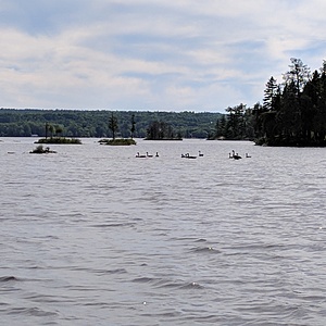
This is in the channel running past Boom Island from Sand Bay. There are islands between this channel and the main river channel which is more on the Ontario side. There have been eagles nesting on the island nearby for at least the last 12 years but the eagles have not used this nesting site this year.

- Group: Ottawa Riverkeeper : Riverwatch
- Lat: 45.5315152
- Lng: -76.5520477
- Waterbody Type: River
- Timezone: America/Toronto
Latest photos
Ottawa River : Near Baie à Wickens in channel downstream from Ile Boom.
Observed on
2019-08-24
Ottawa River : Near Baie à Wickens in channel downstream from Ile Boom.
Observed on
2018-09-28
Mostly cloudy and breezy. Spotted ducks and geese. No human activity on river this morning.
Ottawa River : Near Baie à Wickens in channel downstream from Ile Boom.
Observed on
2018-09-14
Ottawa River : Near Baie à Wickens in channel downstream from Ile Boom.
Observed on
2018-07-30
Investigators: Joan and Kevin McComas, Jennifer Haughton Weather in past 24 hours: showers (9.0m...
Ottawa River : Near Baie à Wickens in channel downstream from Ile Boom.
Observed on
2018-07-29
Ottawa River : Near Baie à Wickens in channel downstream from Ile Boom.
Observed on
2018-06-22
High partial clouds. Light winds. Leaves and sticks on the water surface at testing site.
Ottawa River : Near Baie à Wickens in channel downstream from Ile Boom.
Observed on
2018-06-02
Noted a Longnose Gar this morning in the shallows nearby. Beautiful sunny day.
Ottawa River : Near Baie à Wickens in channel downstream from Ile Boom.
Observed on
2017-10-06
My thermometer was not functioning so inaccurate reading for water temperature. Did not record he...
Ottawa River : Near Baie à Wickens in channel downstream from Ile Boom.
Observed on
2017-09-01
A cool night and a clear but cold and windy day. Had trouble getting the anchor to hold it was so...
Ottawa River : Near Baie à Wickens in channel downstream from Ile Boom.
Observed on
2017-07-29
Latitude: 45.5318 Longitude: - 76.5527
