Ottawa River watershed
Ontario, Canada
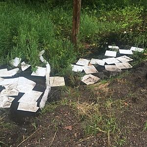
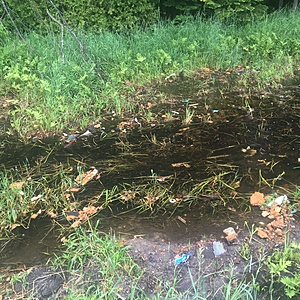
Small ephemeral wetland along a ditch near the intersection of Hwy 17 and Storyland Rd.

- Group: Protect Our Waters
- Lat: 45.5334392
- Lng: -76.6957283
- Waterbody Type: River
- Timezone: America/Toronto
Latest photos
View all photosSample location reasoning: an accident involving significant damage to the adjacent wetland. Sampling this location as there has been little to no effort to maintain the contaminant. Municipality has been notified and the MOECC. Only after we started posting pix on a social media site did they respond to our inquires and take the necessary measure to contain the spread of pollution.
Picture will be added soon
Sample location reasoning: an accident involving significant damage to the adjacent wetland. Monitoring this location as there has been little to no effort to maintain the contaminant. Municipality has been notified and the MOECC. Only after we started posting pix on a social media site did they respond to our inquires and take the necessary measure to contain the spread of pollution.
24-07-2017-1
Sample location reasoning: an accident involving significant damage to the adjacent wetland. Monitoring this location as there has been little to no effort to maintain the contaminant. Municipality has been notified and the MOECC. Only after we started posting pix on a social media site did they respond to our inquires and take the necessary measure to contain the spread of pollution.
Picture will be added soon - 3 samples taken for comparison up from plume, in the area of contamination and down stream from suspected pollution.

