Muskrat Lake Watershed
Ontario, Canada

- Group: Water Rangers : Explorer's team
- Lat: 45.7355266
- Lng: -77.0000839
- Waterbody Type: Lake
- Timezone: America/Toronto
Latest photos
View all photoslarge amounts of filamentous algae and substrate vegetation
Rained in the morning, sunny rest of day.
Some pictures from my shoreline clean up today and the Muskrat Lake Boat Launch. I think someone knew I was coming because they left me a broom to help clean up😜👍🏽 5 full bags of garbage, and various plastic and metal garbage. Diaper bin, outboard motor blade, car parts, styrofoam, bottles and cans.
Heavy rain, 9.1 degrees centigrade
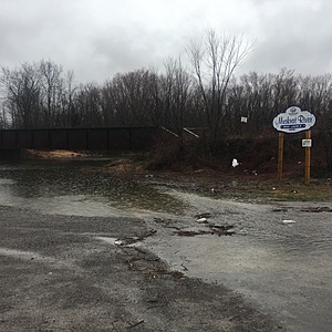
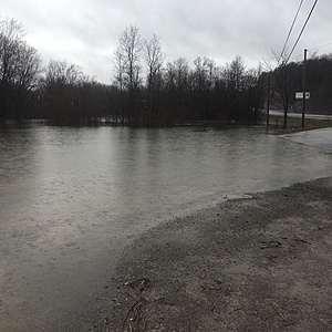
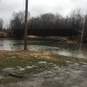
Muskrat River is high and fast. Lots of flooding along the riverbank. Debris floating past. Boat launch and parking lot are flooded.
Muskrat River at Hwy 17
Macrophyte 50%, Periphyton (1-5) 2
Wind 5km W, Cloud cover 0%, Sunset, cool weather. Zebra mussels, some blue green(pea soup clumps), some duck weed. Sampled after overnight rainfall.
WATER GAUGE MOVED UNDER BRIDGE-WE DID NOT MOVE IT.
344384 E, 5066594 N - NTUs
Station data record
Muskrat River at Hwy 17
Macrophyte 75%, Periphyton (1-5) 3
Wind 5km W, Cloud cover 20%, Sunny. Fish, frogs, snails, zebra mussels, gloeotrichia.
344384 E, 5066594 N - NTUs
Station data record
Muskrat River at Hwy 17
Samples taken by the MOECC and uploaded to add a baseline.
Macrophyte 10%, Periphyton (1-5) : 2
Wind 5km S, Cloud cover 50%, Sunny, minnows, algae, zebra mussels. Sampled after heavy rainfall.
344384 E, 5066594 N - NTUs
Station data record
Muskrat River at Hwy 17
Samples taken by the MOECC and uploaded to add a baseline.
Macrophyte 72%, Periphyton (1-5) : 2
Wind 5km NW, Cloud cover 5%, Sunny. Frogs.
344384 E, 5066594 N - NTUs
Station data record
Muskrat River at Hwy 17
Samples taken by the MOECC and uploaded to add a baseline.
Water Level: 93 cm
Macrophyte 10%, Periphyton (1-5) : 3
Wind 10km SE, Cloud cover 95%, Overcast, mild misty rain. Bullfrog, tadpoles and crayfish.
344384 E, 5066594 N - NTUs
Station data record


