Big Rock Creek
Big Rock, Illinois, United States
Big Rock Creek at Big Rock Forest Preserve pedestrian bridge (Kane County Forest Preserve District)

- Lat: 41.7374717
- Lng: -88.5102796
- Waterbody Type: Creek
- Timezone: America/Chicago
Latest photos
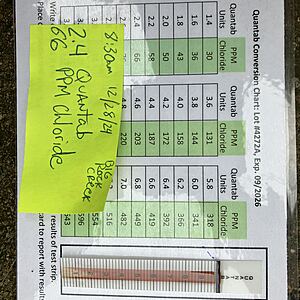
View all photosSecond test strip used and reflected 50 ppm. See pictures, both test strips were very close.
Area around the creek flooded from rainfall the last 24 hours and still frozen ground
I entered in 28 chloride level as it was the lowest level on the quantab conversion chart. Quantab units observed was 0.8, which would be lower than 28.
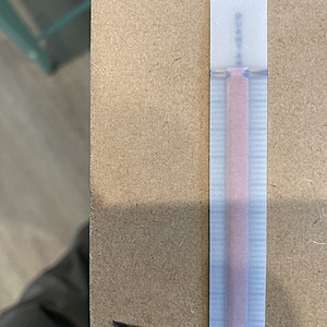
Another item to note is that the test strip used did not make a full solid dark line as all previous strips had done. I waited 20 minutes but had to stop due to a storm coming in (previous samples took more like 5 to 10 min to fill in the solid black line). I included a picture of the backside of the strip and this appears to have been an issue with the strip as the orange bar looks to be placed higher than on the other strips, so that it covered over the area that normally forms a solid black line.
Duplicate test completed (both tests had same chloride levels)
The first significant snowfall of the season started about 10 hours before making the observation.


