Ottawa River Tributary
Ontario, Canada
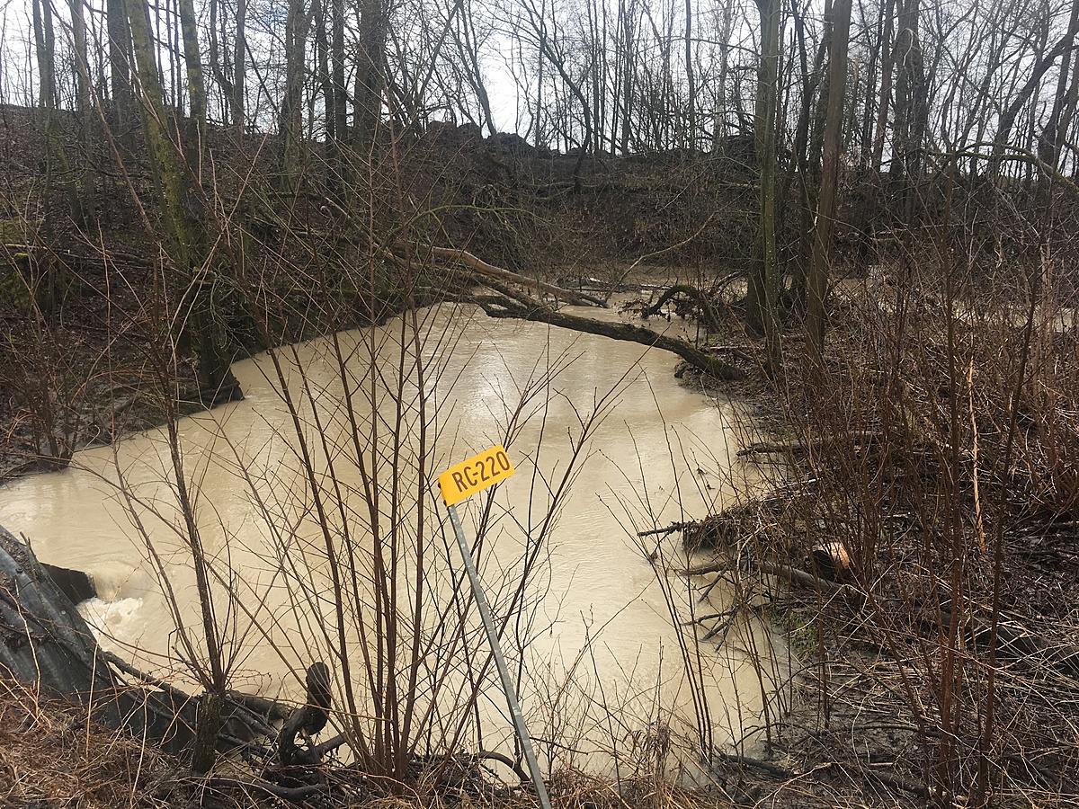
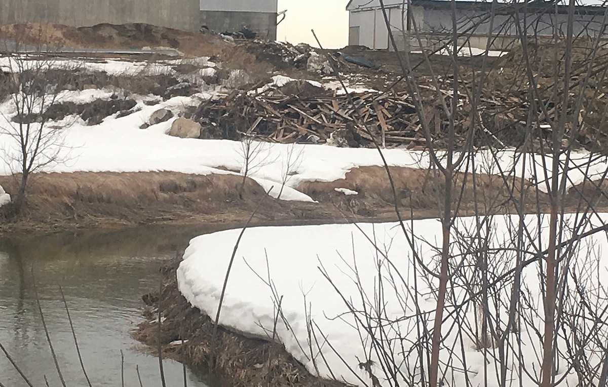
Station #1. Farm on the corner of La Passe Rd. With a construction dump spot 1 meter from creek. Investigating the impact the surrounding farm runoff has on this section of the Ottawa River
Location created by
Jennifer Valentine
- Group: Protect Our Waters
- Lat: 45.7677924
- Lng: -76.8288517
- Waterbody Type: River
- Timezone: America/Toronto
Latest photos
Heavy rainfall. Been raining for 24 hours.
Stream level is high. Lots of flooding and debris in water. Current is swift.
Large flocks of Canada geese in fields.
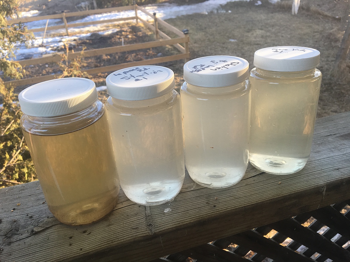
%NaCl: 0.010 mg/l
Cl(negative): 58 mg/l
Performed lab analysis of samples taken 02/04/2017. Performed tests for Total Suspended Solids (TSS) and Ammonia using a Hach DR3900 (TSS followed the photometric method and Ammonia was analyzed using the salicylate method).
Results:
TSS: 48 mg/L
Ammonia: 0.3 mg/L
Discussion:
The results indicate that between this sample site and the sample site located 800 meters downstream there is an increase in both ammonia and TSS (a significant increase in TSS, over double the amount) as the stream flows through the farm. Ongoing monitoring and data collection will continue.
The fact that our sample was cleaner before this area is a sign that this pile of construction garbage so close to the creek might not be the most ecofriendly decision. Sample #2 in the picture is Was collected here. Just around the corner is where sample #3 was collected and you can see a difference in clarity. In comparison to the other samples collected #4 is above on the same stream.
The number six will not enter on the mobile version so I will write the results below to confirm the data is in and when it is fixed I will update the entry
pH :Six.six
Temp :six.4