Ottawa River Tributary
Ontario, Canada
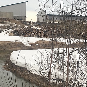
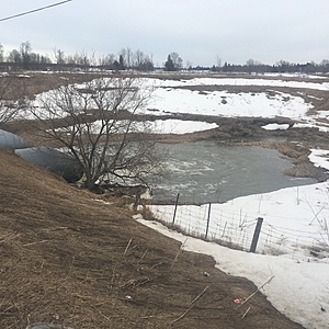
Station #2. Farm with an abundance of runoff possibles as the tributary winds around property multiple times. Piles of lumber and construction waste piled up against the creek bed.

- Group: Protect Our Waters
- Lat: 45.7663554
- Lng: -76.8255687
- Waterbody Type: River
- Timezone: America/Toronto
Latest photos
View all photosPicture 1. Taken at six thirty six pm.
Picture 2. Taken at six fourty two pm
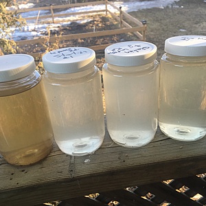
The spike in the pH should not be surprising, heavy rainfall in the past 24 hrs has increased snow melt from the surrounding beef farm. There is some construction happening on the farm, as a result a pile of building waste is located meters from the creek bank. Runoff is the suspected cause; samples collected downstream are significantly more cloudy ⛅️.
Lab tests were performed on samples from 02/04/2017. The samples were analyzed for Total Suspended Solids (TSS) and Ammonia. TSS was analyzed using method 8006, photometric method, and Ammonia was analyzed using method 10031 (salicylate method).
Results:
Ammonia: 0.5 mg/L
TSS: 139 mg/L
Discussion:
This site is located 800 meters downstream from another site we are monitoring. The stream passes through property that is an active farm. Construction activities are currently occurring on farm and debris is located within 5m of the stream. This particular sample had double the TSS from the upstream site. There is a possibility that the construction activities have an influence on increasing runoff into the stream.
Monitoring this site will continue on a regular weekly basis and after significant rain events if possible.
Station 1 & 2 differ in clarity. Both a pale white in comparison to our two other samples from above and below this section, which eventually flows into the Ottawa River.
Beautiful sunny day. Wind 15km/N, 38% Humidity. Saw 2 Sandhill cranes on my morning bike ride.


