Landings Wood Stream
Farncombe, Surrey, United Kingdom
Landing Wood Stream runs off the River Wey (in Godalming, Surrey, UK) on a small housing estate of 65 residences. There is a woodland of just under 4 acres on its north side, through which Landing Wood Stream runs. The channel that feeds the stream runs off the River Wey's north bank on one side of the estate, channelled through a buried conduit beneath the estate's roadway; then emerges in one corner of the woodland, and flows, meandering, roughly north and east until it flows into a mill cutting channel, which itself rejoins the River Wey and the Godalming Navigation a little farther downstream. Godalming Navigation borders the north side of the estate, effectively creating an 'island`, on which the houses of the estate are built.

Location created by
David M Jones
- Site ID: buns.arena.tall
- Lat: 51.1897264
- Lng: -0.5975103
- Waterbody Type: Stream
- Timezone: Europe/London
Latest photos
We are pleased to report that our little stream is flowing strongly now. As it was before a blockage occurred last year in the under-the-road passageway where the River Wey, Godalming flows into Landings Wood Stream to flow through our woodland before rejoining a mill-cut, which flows back into the River. Wey downstream.
We are glad to report that the partial blockage of flow reported in our test of a few months ago seems to have been cleared.
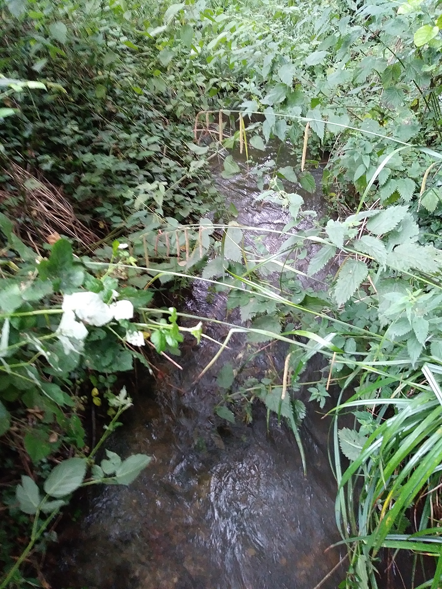
Landings Wood Stream runs through a much vegetated woodland with abundant bird and insect life; and some mammals. While testing, a wren nesting in a nearby tree was a little agitated by our presence, but it was OK. :-)
All fine. Still working on the slight blockage reported last month.
We have LOTS of new information.
1. See attached annotated map of Godalming, Catteshall Tithe Map 1844.
2. When the small housing estate of 1985 was built on the island created by the R. Wey / 'Mill Stream' and Navigation [cut in the mid-18th Cent.], we assumed that the source of Landings Wood Stream, meandering basically N–S through the woodland [Tithe Map area numbers 6, 15, 16 and 17], was off the R. Wey / 'Mill Stream' to the East. We thought it flowed from the R. Wey at C [on map] and had been channeled beneath the road on the estate [the 1985 estate road crosses N–S over C to C on the map], emerging behind a set of garages to run North (i.e. towards our testing site at A).
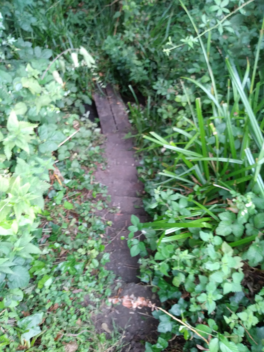
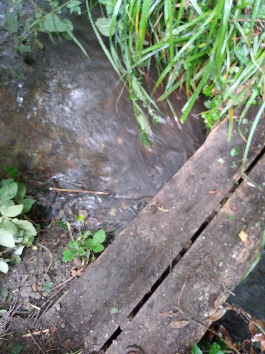
3. See new photos of the stream, showing how much more shallow it has been for the latest two testings!
4. We investigated what we thought was a blockage or other obstruction at C [west end]; even entering the stream and probing into the channeling pipe.
5. This did not unblock anything and the stream has been shallow, with a reduced flow, for the past eight weeks.
6. So we investigated and found the Tithe Map of 1844, which shows that in fact the source and underground pipe channelling of the stream originates at D.
7. Apparently, the stream flowed openly until, the housing estate was built, when the section of the stream between C and D was buried and piped, to level the ground for the houses and garages over it at Tithe plot number 17.
8. The west end of this pipe is therefore at the Navigation, and apparently quite deep.
9. We have had a LOT of rain this winter and recently note that many banks and areas of the R. Wey / 'Mill Stream' have had sand bank deposits that make sections shallow enough in the river itself for a person to stand in it. [We even noticed a heron standing in the middle of the 'Modern Mill Cut' [see map!]
10. It seems there has been a significant build-up of sand btw in the river and in the Navigation and has partially blocked the inflow into Landings Wood Stream at D.
10. So, because the shallowness of only a 4–5 inches / 100–125mm at our original testing site at A makes testing difficult, we took this latest test from a new site.
11. The NEW Testing site is a B on the map, where Landings Wood Stream emerges from the woodland to join the Mill Cut, as shown on our annotated map. WE feel confident that the readings from Site B will be similar to those that we have been taking at site A.
Results of testing this small woodland stream for a year now seem to be fairly consistent. :-)
It is a 'happy' stream, shallow, and can even be jumped across at some points. Its principal purpose and existence are as an 'outlet' off the River Wey approximately one mile east of Godalming, Surrey, UK.
Flow comes off the R. Wey into an underground pipe beneath our housing estate's road, from south to north, then literally bubbles up audibly into Landings Wood Stream to flow on a sandy, gravelly base through the 3.75-acre woodland owned by the housing estate of 60 houses, on an 'island' created by a loop of the R. Wey around the south side of the estate and an 18-century navigation of the R. Way on the north side of the woodland.
Landings Wood Stream joins a former watermill 'cut' or race, approximately 800 yards to the east of the under-road pipe off the R. Wey described above, within the housing estate; and this former mill race flows north to rejoin the R. Wey as it continues towards north-east towards Guildford, Surrey, UK.
Thus the water in the stream comes directly from the R. Wey and from street storm drains on the housing estate, mostly from rainfall and from seeps, springs and streams up-river feeding the R. Wey.
Nothing extraordinary. :-)
Happy little stream running off the River Wey through a lush woodland.
Happy little stream in pleasant woodland. Water colour usually reported as 'clear', but really should be 'very, very slightly tinged amber' :-) But small fish easily seen in water, no smell or algal growth. Stream flows over sand and small gravel bedding.
There are always a few birds around in the trees of this woodland environment adjacent to a small housing estate.