
Cedar Creek
Ontario, Canada
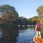
Basin that feeds directly into Lake Erie. Used for fishing, canoeing, kayaking, paddle boarding, swimming.
Location created by
Isabelle Kolodziej
- Group: Lake Erie Rangers : Lake Erie Guardians (2021-2023)
- Lat: 42.0285562
- Lng: -82.8293395
- Waterbody Type: Creek
- Timezone: America/Toronto
Latest photos


There are currently no issues at this location.