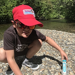
River of Golden Dreams
Whistler, British Columbia, Canada
Just downstream of where the outflow of Alta Lake joins 19 Mile creek, at the beach facing the water depth marker. The water is flowing and shallow a lot of the year, but can flood in spring and fall.

Location created by
Jane Millen
- Group: Myrtle Philip Community School : students
- Lat: 50.1271265
- Lng: -122.9724169
- Waterbody Type: Creek
- Timezone: America/Vancouver
Latest photos
River of Golden Dreams : bottom of Lorimer Road
Observed on
2024-06-20
The river was a bit higher and faster today. 7metres in 5 seconds vs last time it was 7m in 7 sec...
River of Golden Dreams : bottom of Lorimer Road
Observed on
2024-06-06
Conductivity was half of usual. Maybe we need to calibrate the conductivity meter, or find out wh...
River of Golden Dreams : bottom of Lorimer Road
Observed on
2024-04-25
River of Golden Dreams : bottom of Lorimer Road
Observed on
2023-04-28
skunk cabbages are 25cm high.
