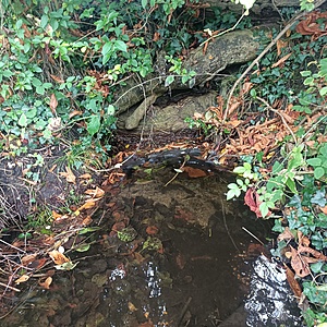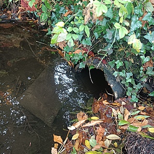
Stream at junction of Polsted Lane and Withies Lane
Farncombe, Surrey, United Kingdom
The point beyond which two streams meet on the other side of the road. Water is moving. What appear to be sand bags are located on one bank of the stream. Maximum depth 6-9".

- Group: River Wey Trust: ZERO Guildford Hub
- Lat: 51.2141863
- Lng: -0.6214351
- Waterbody Type: Stream
- Timezone: Europe/London
Latest photos
View all photosA few dead branches to the side of the main channel on accumulated sand (bank of stream). The pipe that drains water to the pond near The Withies Pub still looks blocked.
Much fuller and deeper than normal. Lots of leaves and some small branches on the surface. The exit point (water drains into a ditch) has become partially blocked and has dammed up some of the water behind it.
Steady to fast flow (compared to the summer), sand at bottom of main channel, silt accumulated to the side of the stream bank (always there), there are a few logs (downstream from the sampling point) obstructing the exit point into the ditch
Steady flow, faster than in the summer, some silt but mostly sand is visible at the bottom of the stream. The water is flowing onward down to the ditch in the field rather than into the pipe that leads to the (dried) pond near The Withies Pub.
Some sediment/sand. From this test point the water flows under a tree into a ditch into a nearby field. A local person walking by said that ideally the water should flow along a pipe to the pond near The Withies Pub but the pipe has become blocked and the pond is now dry. Water should flow out of The Withies Pond into a brook. Apparently Surrey County Council (SCC) are going to try and unblock the pipe in the autumn (November?). The pipe is under common land i.e. not owned by anybody hence the reason why SCC will be doing the work.
There is some hanging growth that is leaning into the stream. Midges seen on the water surface.
Black (ballast?) Bags still present - to support stream bank on roadside? Got speaking to a local walker who mentioned a blocked (with tree roots) rainwater/sewer pipe in the vicinity, not sure how close this is to my two test sites in Compton
There was a small amount of foam close to the exit pipe that takes the stream into a nearby field. For the time being I have stated the water level as "average" but this may change as I become more familiar with this location.


